Derramaderos geodata
Derramaderos (San Luis Potosí) is a populated place; located in Mexico in America/Mexico_City (GMT-6) time zone. With population of 532 people, there are 15923 cities with bigger population in this country. Compared to other cities in Mexico, 85.7% of cities are located further ↓South; 74.5% of cities are located further →East and 73.5% of cities have lower elevation than Derramaderos. Note1


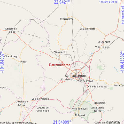
Derramaderos GPS coordinates[2]
22° 17' 35.016" North, 101° 8' 12.984" West
| Map corner | latitude | longitude |
|---|---|---|
| Upper-left | 22.9421°, | -101.84007° |
| Center: | 22.29306°, | -101.13694° |
| Lower-right: | 21.64099°, | -100.43382° |
| Map W x H: | 144.7×144.7 km | = 89.9×89.9mi |
| max Lat: | 32.7° ⇑14.3% North |
| Derramaderos: | 22.29306° |
| min Lat: | ⇓85.7% South 14.53588° |
| min Long | Derramaderos | max Long |
| -117.105° | -101.13694° | -86.73105° |
| W 25.5%⇐ | ⇒74.5% E |
Elevation
Elevation of Derramaderos is 2000 m = 6562 ft, and this is 746.3 m = 2448 ft above average elevation for this country.
| Max E: |
3497 m = 11473 ft | 26.5% |
| Derramaderos | 2000 m 6562 ft | |
| Avg. | 1253.7 m = 4113 ft | |
Min E: |
-1 m = -3 ft | 73.5% |
See also: Mexico elevation on elevation.city.
Geographical zone
Derramaderos is located in North Torrid zone (between Equator and Tropic of Cancer). Distance of this Northern Tropic circle is 127.2 km =79 mi to North.| Distance of | km | miles | from Derramaderos |
|---|---|---|---|
| North Pole | 7528.3 | 4677.9 | to North |
| Arctic Circle | 4922.4 | 3058.6 | to North |
| Tropic Cancer | 127.2 | 79 | to North |
| Equator | 2478.8 | 1540.3 | to South |


Nearby cities:
15 places around Derramaderos: (largest is in red/bold)
• Cerrito de Jaral
10.9 km =6.8 mi,  135°
135°
• El Carrizal
6.2 km =3.9 mi,  329°
329°
• La Campana
7.6 km =4.7 mi, 141°
• Las Moras
6.6 km =4.1 mi,  117°
117°
• Los Retes
8.9 km =5.5 mi, 122°
• Matancillas
8.9 km =5.5 mi,  108°
108°
• Mexquitic de Carmona
3.9 km =2.4 mi, 139°
• Milpillas
4.6 km =2.9 mi,  171°
171°
• Palmar Primero
9.5 km =5.9 mi,  24°
24°
• Puerto de Providencia
10.9 km =6.8 mi,  42°
42°
• Ranchería de Guadalupe
7.2 km =4.5 mi,  293°
293°
• Rincón de San José
2.9 km =1.8 mi,  247°
247°
• Rincón del Porvenir
5.3 km =3.3 mi,  309°
309°
• San Juan (San Juan de Coyotillos)
10.4 km =6.5 mi,  340°
340°
• Suspiro Picacho
10.5 km =6.5 mi,  150°
150°
Sources, notices
• [Note1] Compared only with cities in Mexico existing in our database
• [Src1] Map data: © OpenStreetMap contributors (CC-BY-SA)
• [Src2] Other city data from geonames.org with taken over terms of usage.
• [Src3] Geographical zone / Annual Mean Temperature by Robert A. Rohde @ Wikipedia
