Ahualulco del Sonido Trece geodata
Ahualulco del Sonido Trece (San Luis Potosí) is a seat of a second-order administrative division; located in Mexico in America/Mexico_City (GMT-6) time zone. With population of 4,492 people, there are 2050 cities with bigger population in this country. Compared to other cities in Mexico, 86.3% of cities are located further ↓South; 74.7% of cities are located further →East and 66.1% of cities have lower elevation than Ahualulco del Sonido Trece. Note1
Current local time in Ahualulco del Sonido Trece:
07:39 AM, MondayDifference from your time zone: hours


Ahualulco del Sonido Trece GPS coordinates[2]
22° 24' 0.684" North, 101° 9' 58.104" West
| Map corner | latitude | longitude |
|---|---|---|
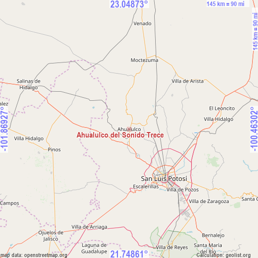
| Upper-left | 23.04873°, | -101.86927° |
| Center: | 22.40019°, | -101.16614° |
| Lower-right: | 21.74861°, | -100.46302° |
| Map W x H: | 144.6×144.6 km | = 89.9×89.9mi |
| max Lat: | 32.7° ⇑13.7% North |
| Ahualulco del Sonido Trece: | 22.40019° |
| min Lat: | ⇓86.3% South 14.53588° |
| min Long | Ahualulco del S | max Long |
| -117.105° | -101.16614° | -86.73105° |
| W 25.3%⇐ | ⇒74.7% E |
Elevation
Elevation of Ahualulco del Sonido Trece is 1854 m = 6083 ft, and this is 600.3 m = 1969 ft above average elevation for this country.
| Max E: |
3497 m = 11473 ft | 33.9% |
| Ahualulco del Sonido Trece | 1854 m 6083 ft | |
| Avg. | 1253.7 m = 4113 ft | |
Min E: |
-1 m = -3 ft | 66.1% |
See also: Mexico elevation on elevation.city.
Geographical zone
Ahualulco del Sonido Trece is located in North Torrid zone (between Equator and Tropic of Cancer). Distance of this Northern Tropic circle is 115.3 km =71.6 mi to North.| Distance of | km | miles | from Ahualulco del Sonido Trece |
|---|---|---|---|
| North Pole | 7516.4 | 4670.5 | to North |
| Arctic Circle | 4910.5 | 3051.2 | to North |
| Tropic Cancer | 115.3 | 71.6 | to North |
| Equator | 2490.7 | 1547.6 | to South |


Nearby cities:
15 places around Ahualulco del Sonido Trece: (largest is in red/bold)
• Barrancas
11 km =6.8 mi,  222°
222°
• Cerrito de Rojas
5.3 km =3.3 mi,  333°
333°
• Colonia Emiliano Zapata (El Chamizal)
6.1 km =3.8 mi,  88°
88°
• Derramaderos
12.3 km =7.6 mi,  165°
165°
• El Carrizal
6.5 km =4 mi,  181°
181°
• El Zapote (Cerrito Blanco)
8.5 km =5.3 mi,  38°
38°
• Encarnación
15.2 km =9.4 mi,  268°
268°
• Palmar Primero
7.7 km =4.8 mi,  115°
115°
• Paso Bonito
12.9 km =8 mi,  229°
229°
• Puerto de Providencia
11 km =6.8 mi,  110°
110°
• Ranchería de Guadalupe
9.7 km =6 mi,  201°
201°
• Rincón de San José
13 km =8.1 mi, 178°
• Rincón del Porvenir
8.6 km =5.3 mi,  187°
187°
• San Juan (San Juan de Coyotillos)
2.1 km =1.3 mi, 192°
• Santa Teresa
14.2 km =8.8 mi,  263°
263°
Sources, notices
• [Note1] Compared only with cities in Mexico existing in our database
• [Src1] Map data: © OpenStreetMap contributors (CC-BY-SA)
• [Src2] Other city data from geonames.org with taken over terms of usage.
• [Src3] Geographical zone / Annual Mean Temperature by Robert A. Rohde @ Wikipedia
