Las Cruces geodata
Las Cruces (Jalisco) is a populated place; located in Mexico in America/Mexico_City (GMT-6) time zone. With population of 759 people, there are 11537 cities with bigger population in this country. Compared to other cities in Mexico, 79.4% of cities are located further ↓South; 80% of cities are located further →East and 65.3% of cities have lower elevation than Las Cruces. Note1


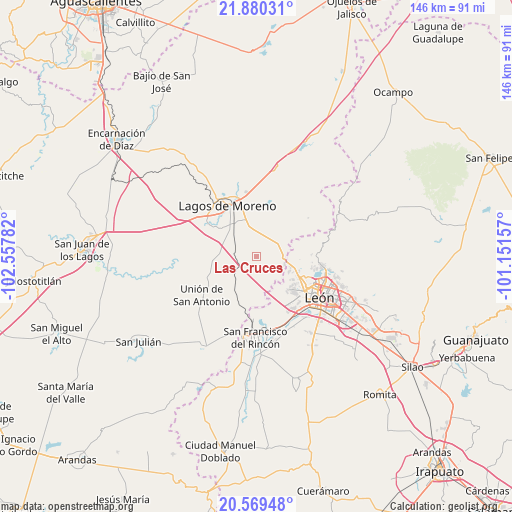
Las Cruces GPS coordinates[2]
21° 13' 34.86" North, 101° 51' 16.884" West
| Map corner | latitude | longitude |
|---|---|---|
| Upper-left | 21.88031°, | -102.55782° |
| Center: | 21.22635°, | -101.85469° |
| Lower-right: | 20.56948°, | -101.15157° |
| Map W x H: | 145.8×145.8 km | = 90.6×90.6mi |
| max Lat: | 32.7° ⇑20.6% North |
| Las Cruces: | 21.22635° |
| min Lat: | ⇓79.4% South 14.53588° |
| min Long | Las Cruces | max Long |
| -117.105° | -101.85469° | -86.73105° |
| W 20%⇐ | ⇒80% E |
Elevation
Elevation of Las Cruces is 1837 m = 6027 ft, and this is 583.3 m = 1914 ft above average elevation for this country.
| Max E: |
3497 m = 11473 ft | 34.7% |
| Las Cruces | 1837 m 6027 ft | |
| Avg. | 1253.7 m = 4113 ft | |
Min E: |
-1 m = -3 ft | 65.3% |
See also: Mexico elevation on elevation.city.
Geographical zone
Las Cruces is located in North Torrid zone (between Equator and Tropic of Cancer). Distance of this Northern Tropic circle is 245.8 km =152.7 mi to North.| Distance of | km | miles | from Las Cruces |
|---|---|---|---|
| North Pole | 7646.9 | 4751.6 | to North |
| Arctic Circle | 5041 | 3132.3 | to North |
| Tropic Cancer | 245.8 | 152.7 | to North |
| Equator | 2360.1 | 1466.5 | to South |


Nearby cities:
15 places around Las Cruces: (largest is in red/bold)
• Centro Familiar la Soledad
14.9 km =9.3 mi,  133°
133°
• Ejido la Joya
15.1 km =9.4 mi, 127°
• El Saucillo de Primavera
6.9 km =4.3 mi,  115°
115°
• Fraccionamiento Paseo de las Torres
11.9 km =7.4 mi, 122°
• Geovillas Laureles del Campanario
13.6 km =8.5 mi,  328°
328°
• Hacienda Arriba
15.6 km =9.7 mi,  87°
87°
• La Ermita
15.1 km =9.4 mi, 123°
• La Patiña
16 km =9.9 mi,  101°
101°
• Lagunillas
9.6 km =6 mi,  106°
106°
• Pedrito [Estación]
11.9 km =7.4 mi,  210°
210°
• Plan de los Rodríguez
13.7 km =8.5 mi,  320°
320°
• Potrerillos (Guanajal)
16.2 km =10.1 mi,  185°
185°
• Real de la Joya
12.9 km =8 mi, 129°
• Rizos de la Joya (Rizos del Saucillo)
12.9 km =8 mi, 131°
• San José del Caliche (El Caliche)
13.7 km =8.5 mi, 214°
Sources, notices
• [Note1] Compared only with cities in Mexico existing in our database
• [Src1] Map data: © OpenStreetMap contributors (CC-BY-SA)
• [Src2] Other city data from geonames.org with taken over terms of usage.
• [Src3] Geographical zone / Annual Mean Temperature by Robert A. Rohde @ Wikipedia
