Covadonga geodata
Covadonga (Coahuila) is a populated place; located in Mexico in America/Monterrey (GMT-6) time zone. With population of 541 people, there are 15692 cities with bigger population in this country. Compared to other cities in Mexico, 95% of cities are located further ↓South; 86.8% of cities are located further →East and 58% of cities have higher elevation than Covadonga. Note1


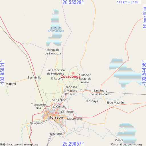
Covadonga GPS coordinates[2]
25° 55' 28.668" North, 103° 14' 51.648" West
| Map corner | latitude | longitude |
|---|---|---|
| Upper-left | 26.55529°, | -103.95081° |
| Center: | 25.92463°, | -103.24768° |
| Lower-right: | 25.29057°, | -102.54456° |
| Map W x H: | 140.6×140.6 km | = 87.4×87.4mi |
| max Lat: | 32.7° ⇑5% North |
| Covadonga: | 25.92463° |
| min Lat: | ⇓95% South 14.53588° |
| min Long | Covadonga | max Long |
| -117.105° | -103.24768° | -86.73105° |
| W 13.2%⇐ | ⇒86.8% E |
Elevation
Elevation of Covadonga is 1102 m = 3615 ft, and this is 151.7 m = 498 ft below average elevation for this country.
| Max E: |
3497 m = 11473 ft | 58% |
| Avg. | 1253.7 m = 4113 ft | |
| Covadonga | 1102 m = 3615 ft | |
Min E: |
-1 m = -3 ft | 42% |
See also: Mexico elevation on elevation.city.
Geographical zone
Covadonga is located in North temperate zone (between Tropic of Cancer and the Arctic Circle). Distance of this Northern Tropic circle is 276.6 km =171.9 mi to South.| Distance of | km | miles | from Covadonga |
|---|---|---|---|
| North Pole | 7124.5 | 4427 | to North |
| Arctic Circle | 4518.6 | 2807.7 | to North |
| Tropic Cancer | 276.6 | 171.9 | to South |
| Equator | 2882.5 | 1791.1 | to South |


Nearby cities:
15 places around Covadonga: (largest is in red/bold)
• Banco Nacional
12.4 km =7.7 mi,  241°
241°
• Colón
8.6 km =5.3 mi,  193°
193°
• Coruña
7 km =4.3 mi,  225°
225°
• El Lequeitio
9.2 km =5.7 mi,  199°
199°
• Emiliano Zapata (Albia)
10.5 km =6.5 mi,  137°
137°
• Finisterre
7.4 km =4.6 mi,  22°
22°
• Florencia
11.4 km =7.1 mi,  212°
212°
• La Fe
9.8 km =6.1 mi,  151°
151°
• La Pinta
3 km =1.9 mi,  215°
215°
• La Victoria
9.8 km =6.1 mi,  133°
133°
• Las Mercedes
10.7 km =6.6 mi, 207°
• San José de la Niña
6.4 km =4 mi, 151°
• Santa María
6.3 km =3.9 mi,  176°
176°
• Sofía de Arriba
9.7 km =6 mi,  79°
79°
• Vega Larga
6.7 km =4.2 mi, 134°
Sources, notices
• [Note1] Compared only with cities in Mexico existing in our database
• [Src1] Map data: © OpenStreetMap contributors (CC-BY-SA)
• [Src2] Other city data from geonames.org with taken over terms of usage.
• [Src3] Geographical zone / Annual Mean Temperature by Robert A. Rohde @ Wikipedia
