Zapotitán de Hidalgo geodata
Zapotitán de Hidalgo (Jalisco) is a populated place; located in Mexico in America/Mexico_City (GMT-6) time zone. With population of 3,449 people, there are 2643 cities with bigger population in this country. Compared to other cities in Mexico, 64.1% of cities are located further ↓South; 88.2% of cities are located further →East and 55.4% of cities have lower elevation than Zapotitán de Hidalgo. Note1
Current local time in Zapotitán de Hidalgo:
05:17 AM, WednesdayDifference from your time zone: hours


Zapotitán de Hidalgo GPS coordinates[2]
20° 19' 35.076" North, 103° 28' 42.276" West
| Map corner | latitude | longitude |
|---|---|---|
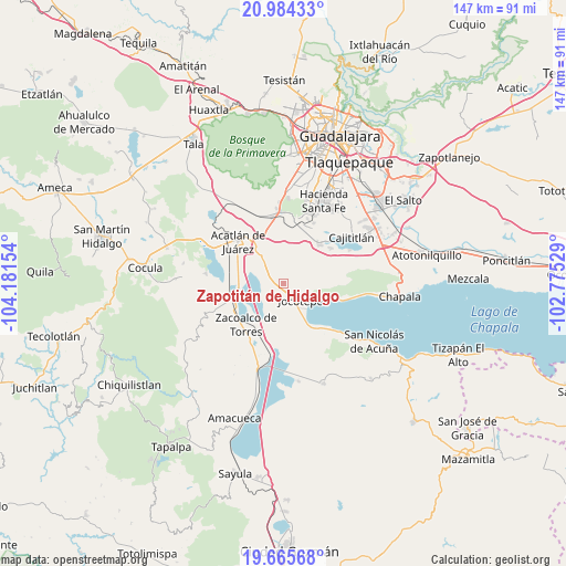
| Upper-left | 20.98433°, | -104.18154° |
| Center: | 20.32641°, | -103.47841° |
| Lower-right: | 19.66568°, | -102.77529° |
| Map W x H: | 146.6×146.6 km | = 91.1×91.1mi |
| max Lat: | 32.7° ⇑35.9% North |
| Zapotitán de Hidalgo: | 20.32641° |
| min Lat: | ⇓64.1% South 14.53588° |
| min Long | Zapotitán de H | max Long |
| -117.105° | -103.47841° | -86.73105° |
| W 11.8%⇐ | ⇒88.2% E |
Elevation
Elevation of Zapotitán de Hidalgo is 1599 m = 5246 ft, and this is 345.3 m = 1133 ft above average elevation for this country.
| Max E: |
3497 m = 11473 ft | 44.6% |
| Zapotitán de Hidalgo | 1599 m 5246 ft | |
| Avg. | 1253.7 m = 4113 ft | |
Min E: |
-1 m = -3 ft | 55.4% |
See also: Mexico elevation on elevation.city.
Geographical zone
Zapotitán de Hidalgo is located in North Torrid zone (between Equator and Tropic of Cancer). Distance of this Northern Tropic circle is 345.8 km =214.9 mi to North.| Distance of | km | miles | from Zapotitán de Hidalgo |
|---|---|---|---|
| North Pole | 7747 | 4813.8 | to North |
| Arctic Circle | 5141.1 | 3194.5 | to North |
| Tropic Cancer | 345.8 | 214.9 | to North |
| Equator | 2260.1 | 1404.4 | to South |


Nearby cities:
15 places around Zapotitán de Hidalgo: (largest is in red/bold)
• Benito Juárez
13.6 km =8.5 mi,  250°
250°
• Buenavista
14.9 km =9.3 mi,  342°
342°
• El Molino
9.1 km =5.7 mi,  319°
319°
• General Andrés Figueroa
13.9 km =8.6 mi,  259°
259°
• Huejotitán
3.3 km =2.1 mi, 343°
• Jocotepec
6.9 km =4.3 mi,  131°
131°
• Potrerillos
10.6 km =6.6 mi,  82°
82°
• San José de los Pozos
9.9 km =6.2 mi,  285°
285°
• San Juan Cosalá
15 km =9.3 mi,  106°
106°
• San Lucas Evangelista
15.3 km =9.5 mi,  53°
53°
• San Marcos
5.9 km =3.7 mi, 261°
• San Miguel Cuyutlán
13.6 km =8.5 mi,  42°
42°
• San Pedro Tesistán
12.9 km =8 mi,  149°
149°
• Villa de los Niños
11.1 km =6.9 mi, 323°
• Zacoalco de Torres
14.4 km =8.9 mi,  220°
220°
Sources, notices
• [Note1] Compared only with cities in Mexico existing in our database
• [Src1] Map data: © OpenStreetMap contributors (CC-BY-SA)
• [Src2] Other city data from geonames.org with taken over terms of usage.
• [Src3] Geographical zone / Annual Mean Temperature by Robert A. Rohde @ Wikipedia
