Villa González Ortega geodata
Villa González Ortega (Zacatecas) is a seat of a second-order administrative division; located in Mexico in America/Mexico_City (GMT-6) time zone. With population of 6,181 people, there are 1508 cities with bigger population in this country. Compared to other cities in Mexico, 86.8% of cities are located further ↓South; 80.4% of cities are located further →East and 80% of cities have lower elevation than Villa González Ortega. Note1


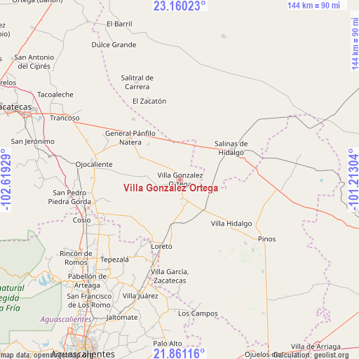
Villa González Ortega GPS coordinates[2]
22° 30' 43.992" North, 101° 54' 58.176" West
| Map corner | latitude | longitude |
|---|---|---|
| Upper-left | 23.16023°, | -102.61929° |
| Center: | 22.51222°, | -101.91616° |
| Lower-right: | 21.86116°, | -101.21304° |
| Map W x H: | 144.4×144.4 km | = 89.7×89.7mi |
| max Lat: | 32.7° ⇑13.2% North |
| Villa González Ortega: | 22.51222° |
| min Lat: | ⇓86.8% South 14.53588° |
| min Long | Villa González | max Long |
| -117.105° | -101.91616° | -86.73105° |
| W 19.6%⇐ | ⇒80.4% E |
Elevation
Elevation of Villa González Ortega is 2140 m = 7021 ft, and this is 886.3 m = 2908 ft above average elevation for this country.
| Max E: |
3497 m = 11473 ft | 20% |
| Villa González Ortega | 2140 m 7021 ft | |
| Avg. | 1253.7 m = 4113 ft | |
Min E: |
-1 m = -3 ft | 80% |
See also: Mexico elevation on elevation.city.
Geographical zone
Villa González Ortega is located in North Torrid zone (between Equator and Tropic of Cancer). Distance of this Northern Tropic circle is 102.8 km =63.9 mi to North.| Distance of | km | miles | from Villa González Ortega |
|---|---|---|---|
| North Pole | 7503.9 | 4662.7 | to North |
| Arctic Circle | 4898 | 3043.5 | to North |
| Tropic Cancer | 102.8 | 63.9 | to North |
| Equator | 2503.1 | 1555.4 | to South |


Nearby cities:
15 places around Villa González Ortega: (largest is in red/bold)
• Azogueros
17.6 km =10.9 mi,  57°
57°
• Bajío de San Nicolás
11.1 km =6.9 mi,  301°
301°
• Colonia Diez de Noviembre (El Campamento)
11.6 km =7.2 mi,  351°
351°
• Colonia Madero (Madero)
13.7 km =8.5 mi,  223°
223°
• El Salitre
18.5 km =11.5 mi,  130°
130°
• El Tule
19.1 km =11.9 mi,  318°
318°
• Estancia de Ánimas
8.6 km =5.3 mi,  251°
251°
• La Lagunita
14.6 km =9.1 mi,  114°
114°
• Las Colonias (Colonia Juárez)
13.7 km =8.5 mi,  68°
68°
• Maravillas
16.2 km =10.1 mi, 219°
• Noria de Ángeles
7.7 km =4.8 mi,  174°
174°
• Pastoría
17.3 km =10.7 mi,  260°
260°
• Providencia
19.3 km =12 mi,  152°
152°
• Santa Elena
18.3 km =11.4 mi, 299°
• Sauceda de Mulatos
18 km =11.2 mi, 249°
Sources, notices
• [Note1] Compared only with cities in Mexico existing in our database
• [Src1] Map data: © OpenStreetMap contributors (CC-BY-SA)
• [Src2] Other city data from geonames.org with taken over terms of usage.
• [Src3] Geographical zone / Annual Mean Temperature by Robert A. Rohde @ Wikipedia
