Pastoría geodata
Pastoría (Zacatecas) is a populated place; located in Mexico in America/Mexico_City (GMT-6) time zone. With population of 1,089 people, there are 7989 cities with bigger population in this country. Compared to other cities in Mexico, 86.6% of cities are located further ↓South; 81.4% of cities are located further →East and 83.4% of cities have lower elevation than Pastoría. Note1


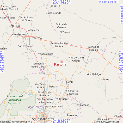
Pastoría GPS coordinates[2]
22° 29' 10.14" North, 102° 4' 54.624" West
| Map corner | latitude | longitude |
|---|---|---|
| Upper-left | 23.13428°, | -102.78497° |
| Center: | 22.48615°, | -102.08184° |
| Lower-right: | 21.83497°, | -101.37872° |
| Map W x H: | 144.5×144.5 km | = 89.8×89.8mi |
| max Lat: | 32.7° ⇑13.4% North |
| Pastoría: | 22.48615° |
| min Lat: | ⇓86.6% South 14.53588° |
| min Long | Pastoría | max Long |
| -117.105° | -102.08184° | -86.73105° |
| W 18.6%⇐ | ⇒81.4% E |
Elevation
Elevation of Pastoría is 2229 m = 7313 ft, and this is 975.3 m = 3200 ft above average elevation for this country.
| Max E: |
3497 m = 11473 ft | 16.6% |
| Pastoría | 2229 m 7313 ft | |
| Avg. | 1253.7 m = 4113 ft | |
Min E: |
-1 m = -3 ft | 83.4% |
See also: Mexico elevation on elevation.city.
Geographical zone
Pastoría is located in North Torrid zone (between Equator and Tropic of Cancer). Distance of this Northern Tropic circle is 105.7 km =65.7 mi to North.| Distance of | km | miles | from Pastoría |
|---|---|---|---|
| North Pole | 7506.8 | 4664.5 | to North |
| Arctic Circle | 4900.9 | 3045.3 | to North |
| Tropic Cancer | 105.7 | 65.7 | to North |
| Equator | 2500.2 | 1553.6 | to South |


Nearby cities:
15 places around Pastoría: (largest is in red/bold)
• Bajío de San Nicolás
11.6 km =7.2 mi,  40°
40°
• Buenavista
12.8 km =8 mi,  241°
241°
• Colonia Madero (Madero)
10.5 km =6.5 mi,  132°
132°
• Estancia de Ánimas
8.9 km =5.5 mi,  88°
88°
• General Lauro G. Caloca (El Rascón)
12.3 km =7.6 mi,  168°
168°
• Jarillas
14 km =8.7 mi,  300°
300°
• Los Griegos
14.7 km =9.1 mi,  253°
253°
• Maravillas
11.7 km =7.3 mi,  145°
145°
• Milagros
10.6 km =6.6 mi,  278°
278°
• Rancho Nuevo
14.2 km =8.8 mi,  345°
345°
• San Pablo
8.3 km =5.2 mi, 347°
• Santa Elena
11.9 km =7.4 mi,  5°
5°
• Santo Tomás Venaditos (Venaditos)
4.6 km =2.9 mi,  327°
327°
• Sauceda de Mulatos
3.3 km =2.1 mi,  177°
177°
• Tierra Blanca
15.5 km =9.6 mi, 173°
Sources, notices
• [Note1] Compared only with cities in Mexico existing in our database
• [Src1] Map data: © OpenStreetMap contributors (CC-BY-SA)
• [Src2] Other city data from geonames.org with taken over terms of usage.
• [Src3] Geographical zone / Annual Mean Temperature by Robert A. Rohde @ Wikipedia
