La Constitución geodata
La Constitución (Chihuahua) is a populated place; located in Mexico in America/Chihuahua (GMT-6) time zone. With population of 2,709 people, there are 3263 cities with bigger population in this country. Compared to other cities in Mexico, 98.4% of cities are located further ↓South; 94.2% of cities are located further →East and 50.9% of cities have higher elevation than La Constitución. Note1


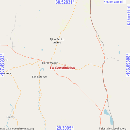
La Constitución GPS coordinates[2]
29° 55' 14.772" North, 106° 47' 46.32" West
| Map corner | latitude | longitude |
|---|---|---|
| Upper-left | 30.52831°, | -107.49933° |
| Center: | 29.92077°, | -106.7962° |
| Lower-right: | 29.3095°, | -106.09308° |
| Map W x H: | 135.5×135.5 km | = 84.2×84.2mi |
| max Lat: | 32.7° ⇑1.6% North |
| La Constitución: | 29.92077° |
| min Lat: | ⇓98.4% South 14.53588° |
| min Long | La Constitució | max Long |
| -117.105° | -106.7962° | -86.73105° |
| W 5.8%⇐ | ⇒94.2% E |
Elevation
Elevation of La Constitución is 1387 m = 4551 ft, and this is 133.3 m = 437 ft above average elevation for this country.
| Max E: |
3497 m = 11473 ft | 50.9% |
| La Constitución | 1387 m 4551 ft | |
| Avg. | 1253.7 m = 4113 ft | |
Min E: |
-1 m = -3 ft | 49.1% |
See also: Mexico elevation on elevation.city.
Geographical zone
La Constitución is located in North temperate zone (between Tropic of Cancer and the Arctic Circle). Distance of this Northern Tropic circle is 721 km =448 mi to South.| Distance of | km | miles | from La Constitución |
|---|---|---|---|
| North Pole | 6680.2 | 4150.9 | to North |
| Arctic Circle | 4074.3 | 2531.7 | to North |
| Tropic Cancer | 721 | 448 | to South |
| Equator | 3326.9 | 2067.2 | to South |


Nearby cities:
15 places around La Constitución: (largest is in red/bold)
• Abdenago C. García
73.2 km =45.5 mi,  275°
275°
• Benito Juárez
85.3 km =53 mi,  190°
190°
• Colonia el Valle
55.5 km =34.5 mi,  290°
290°
• Ejido Benito Juárez
26.8 km =16.7 mi,  341°
341°
• Galeana
81.8 km =50.8 mi, 285°
• Hermenegildo Galeana
81.8 km =50.8 mi, 285°
• Las Cruces
78.9 km =49 mi,  226°
226°
• Lázaro Cárdenas
92.7 km =57.6 mi, 193°
• Miguel Ahumada
82.2 km =51.1 mi,  19°
19°
• Namiquipa
95.4 km =59.3 mi,  218°
218°
• Ojo Caliente
68 km =42.3 mi, 20°
• Rodrígo M. Quevedo
69.8 km =43.4 mi,  269°
269°
• San Buenaventura
64.6 km =40.1 mi,  262°
262°
• San Lorenzo
29.4 km =18.3 mi,  246°
246°
• Santa Catalina de Villela
84 km =52.2 mi, 191°
Sources, notices
• [Note1] Compared only with cities in Mexico existing in our database
• [Src1] Map data: © OpenStreetMap contributors (CC-BY-SA)
• [Src2] Other city data from geonames.org with taken over terms of usage.
• [Src3] Geographical zone / Annual Mean Temperature by Robert A. Rohde @ Wikipedia
