Ojo Caliente geodata
Ojo Caliente (Chihuahua) is a populated place; located in Mexico in America/Chihuahua (GMT-6) time zone. With population of 514 people, there are 16370 cities with bigger population in this country. Compared to other cities in Mexico, 98.6% of cities are located further ↓South; 94.1% of cities are located further →East and 54.7% of cities have higher elevation than Ojo Caliente. Note1


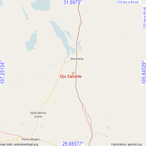
Ojo Caliente GPS coordinates[2]
30° 29' 36.672" North, 106° 32' 54.276" West
| Map corner | latitude | longitude |
|---|---|---|
| Upper-left | 31.0975°, | -107.25154° |
| Center: | 30.49352°, | -106.54841° |
| Lower-right: | 29.88577°, | -105.84529° |
| Map W x H: | 134.7×134.7 km | = 83.7×83.7mi |
| max Lat: | 32.7° ⇑1.4% North |
| Ojo Caliente: | 30.49352° |
| min Lat: | ⇓98.6% South 14.53588° |
| min Long | Ojo Caliente | max Long |
| -117.105° | -106.54841° | -86.73105° |
| W 5.9%⇐ | ⇒94.1% E |
Elevation
Elevation of Ojo Caliente is 1210 m = 3970 ft, and this is 43.7 m = 143 ft below average elevation for this country.
| Max E: |
3497 m = 11473 ft | 54.7% |
| Avg. | 1253.7 m = 4113 ft | |
| Ojo Caliente | 1210 m = 3970 ft | |
Min E: |
-1 m = -3 ft | 45.3% |
See also: Mexico elevation on elevation.city.
Geographical zone
Ojo Caliente is located in North temperate zone (between Tropic of Cancer and the Arctic Circle). Distance of this Northern Tropic circle is 784.6 km =487.5 mi to South.| Distance of | km | miles | from Ojo Caliente |
|---|---|---|---|
| North Pole | 6616.5 | 4111.3 | to North |
| Arctic Circle | 4010.6 | 2492.1 | to North |
| Tropic Cancer | 784.6 | 487.5 | to South |
| Equator | 3390.6 | 2106.8 | to South |


Nearby cities:
15 places around Ojo Caliente: (largest is in red/bold)
• Barreales
107.9 km =67 mi,  21°
21°
• Colonia el Valle
87.3 km =54.2 mi,  239°
239°
• Ejido Benito Juárez
50 km =31.1 mi,  220°
220°
• Esperanza
108.6 km =67.5 mi,  31°
31°
• Galeana
110.9 km =68.9 mi,  247°
247°
• Guadalupe
108.2 km =67.2 mi, 22°
• Hermenegildo Galeana
110.9 km =68.9 mi, 247°
• La Constitución
68 km =42.3 mi,  200°
200°
• Miguel Ahumada
14.3 km =8.9 mi,  13°
13°
• Porvenir
104.9 km =65.2 mi,  37°
37°
• Praxedis G. Guerrero
110.4 km =68.6 mi, 27°
• Praxédis Guerrero
109.5 km =68 mi, 27°
• Rinconada del Mimbre
106.2 km =66 mi, 26°
• Samalayuca
94.6 km =58.8 mi,  3°
3°
• San Lorenzo
90.9 km =56.5 mi,  213°
213°
Sources, notices
• [Note1] Compared only with cities in Mexico existing in our database
• [Src1] Map data: © OpenStreetMap contributors (CC-BY-SA)
• [Src2] Other city data from geonames.org with taken over terms of usage.
• [Src3] Geographical zone / Annual Mean Temperature by Robert A. Rohde @ Wikipedia
