Tuitán geodata
Tuitán (Durango) is a populated place; located in Mexico in America/Monterrey (GMT-6) time zone. With population of 870 people, there are 10041 cities with bigger population in this country. Compared to other cities in Mexico, 90.1% of cities are located further ↓South; 90.5% of cities are located further →East and 67.2% of cities have lower elevation than Tuitán. Note1


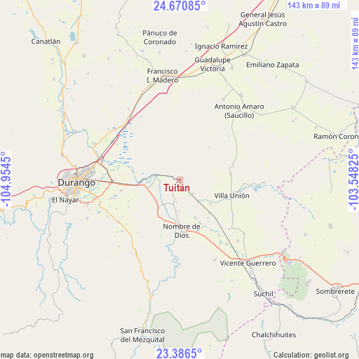
Tuitán GPS coordinates[2]
24° 1' 49.008" North, 104° 15' 4.932" West
| Map corner | latitude | longitude |
|---|---|---|
| Upper-left | 24.67085°, | -104.9545° |
| Center: | 24.03028°, | -104.25137° |
| Lower-right: | 23.3865°, | -103.54825° |
| Map W x H: | 142.8×142.8 km | = 88.7×88.7mi |
| max Lat: | 32.7° ⇑9.9% North |
| Tuitán: | 24.03028° |
| min Lat: | ⇓90.1% South 14.53588° |
| min Long | Tuitán | max Long |
| -117.105° | -104.25137° | -86.73105° |
| W 9.5%⇐ | ⇒90.5% E |
Elevation
Elevation of Tuitán is 1874 m = 6148 ft, and this is 620.3 m = 2035 ft above average elevation for this country.
| Max E: |
3497 m = 11473 ft | 32.8% |
| Tuitán | 1874 m 6148 ft | |
| Avg. | 1253.7 m = 4113 ft | |
Min E: |
-1 m = -3 ft | 67.2% |
See also: Mexico elevation on elevation.city.
Geographical zone
Tuitán is located in North temperate zone (between Tropic of Cancer and the Arctic Circle). Distance of this Northern Tropic circle is 66 km =41 mi to South.| Distance of | km | miles | from Tuitán |
|---|---|---|---|
| North Pole | 7335.1 | 4557.8 | to North |
| Arctic Circle | 4729.3 | 2938.6 | to North |
| Tropic Cancer | 66 | 41 | to South |
| Equator | 2671.9 | 1660.2 | to South |


Nearby cities:
15 places around Tuitán: (largest is in red/bold)
• Amado Nervo
21.7 km =13.5 mi,  162°
162°
• Cieneguillas
20.4 km =12.7 mi,  82°
82°
• Damián Carmona
15.7 km =9.8 mi,  129°
129°
• El Arenal
18.9 km =11.7 mi,  281°
281°
• El Potosí
17.8 km =11.1 mi,  121°
121°
• Héroe de Nacozari
13.4 km =8.3 mi,  265°
265°
• Independencia y Libertad
9.1 km =5.7 mi, 280°
• La Constancia
12.8 km =8 mi,  186°
186°
• Los Ángeles
15.6 km =9.7 mi, 128°
• Nombre de Dios
20.2 km =12.6 mi,  178°
178°
• Orizaba
19.8 km =12.3 mi,  114°
114°
• Primero de Mayo
10 km =6.2 mi, 269°
• Santa Cruz de Guadalupe
21.2 km =13.2 mi, 159°
• Villa Montemorelos
23.7 km =14.7 mi,  259°
259°
• Villa Unión
21.7 km =13.5 mi, 106°
Sources, notices
• [Note1] Compared only with cities in Mexico existing in our database
• [Src1] Map data: © OpenStreetMap contributors (CC-BY-SA)
• [Src2] Other city data from geonames.org with taken over terms of usage.
• [Src3] Geographical zone / Annual Mean Temperature by Robert A. Rohde @ Wikipedia
