Tlacote el Alto geodata
Tlacote el Alto (Querétaro) is a populated place; located in Mexico in America/Mexico_City (GMT-6) time zone. With population of 518 people, there are 16254 cities with bigger population in this country. Compared to other cities in Mexico, 71.5% of cities are located further ↓South; 69.8% of cities are located further →East and 70.6% of cities have lower elevation than Tlacote el Alto. Note1


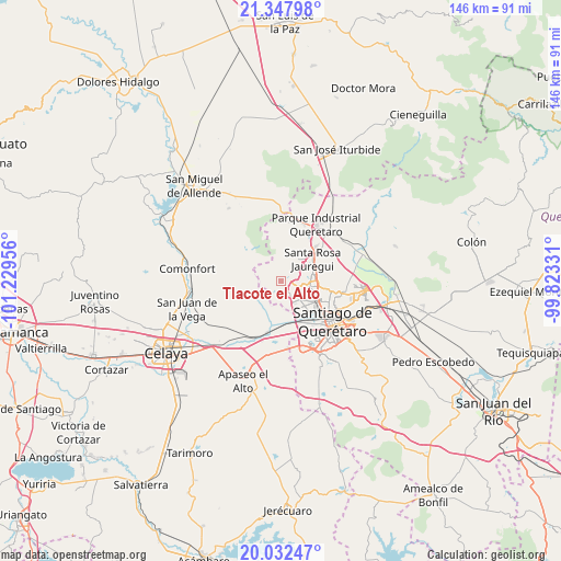
Tlacote el Alto GPS coordinates[2]
20° 41' 29.94" North, 100° 31' 35.148" West
| Map corner | latitude | longitude |
|---|---|---|
| Upper-left | 21.34798°, | -101.22956° |
| Center: | 20.69165°, | -100.52643° |
| Lower-right: | 20.03247°, | -99.82331° |
| Map W x H: | 146.3×146.3 km | = 90.9×90.9mi |
| max Lat: | 32.7° ⇑28.5% North |
| Tlacote el Alto: | 20.69165° |
| min Lat: | ⇓71.5% South 14.53588° |
| min Long | Tlacote el Alto | max Long |
| -117.105° | -100.52643° | -86.73105° |
| W 30.2%⇐ | ⇒69.8% E |
Elevation
Elevation of Tlacote el Alto is 1937 m = 6355 ft, and this is 683.3 m = 2242 ft above average elevation for this country.
| Max E: |
3497 m = 11473 ft | 29.4% |
| Tlacote el Alto | 1937 m 6355 ft | |
| Avg. | 1253.7 m = 4113 ft | |
Min E: |
-1 m = -3 ft | 70.6% |
See also: Mexico elevation on elevation.city.
Geographical zone
Tlacote el Alto is located in North Torrid zone (between Equator and Tropic of Cancer). Distance of this Northern Tropic circle is 305.2 km =189.6 mi to North.| Distance of | km | miles | from Tlacote el Alto |
|---|---|---|---|
| North Pole | 7706.4 | 4788.5 | to North |
| Arctic Circle | 5100.5 | 3169.3 | to North |
| Tropic Cancer | 305.2 | 189.6 | to North |
| Equator | 2300.7 | 1429.6 | to South |


Nearby cities:
15 places around Tlacote el Alto: (largest is in red/bold)
• Acequia Blanca
6.9 km =4.3 mi,  63°
63°
• Casa Blanca
7.1 km =4.4 mi,  18°
18°
• El Nabo
4.8 km =3 mi,  87°
87°
• El Zapote
4.5 km =2.8 mi,  192°
192°
• Huertas la Joya [Fraccionamiento Campestre]
8 km =5 mi,  161°
161°
• Ixtla
7.8 km =4.8 mi,  236°
236°
• Jardines de Azucenas (La Floresta)
8.1 km =5 mi,  144°
144°
• Juriquilla
7.7 km =4.8 mi,  72°
72°
• Mompaní
2 km =1.2 mi, 88°
• Praga
3 km =1.9 mi,  149°
149°
• Rancho la Tinaja
4.2 km =2.6 mi,  305°
305°
• San Francisco de la Palma
3.7 km =2.3 mi, 161°
• San Miguelito
5.6 km =3.5 mi,  25°
25°
• Tierra Blanca
8.2 km =5.1 mi,  274°
274°
• Tlacote el Bajo
3.9 km =2.4 mi, 149°
Sources, notices
• [Note1] Compared only with cities in Mexico existing in our database
• [Src1] Map data: © OpenStreetMap contributors (CC-BY-SA)
• [Src2] Other city data from geonames.org with taken over terms of usage.
• [Src3] Geographical zone / Annual Mean Temperature by Robert A. Rohde @ Wikipedia
