San Miguelito geodata
San Miguelito (Querétaro) is a populated place; located in Mexico in America/Mexico_City (GMT-6) time zone. With population of 3,133 people, there are 2883 cities with bigger population in this country. Compared to other cities in Mexico, 72.3% of cities are located further ↓South; 69.5% of cities are located further →East and 77.2% of cities have lower elevation than San Miguelito. Note1


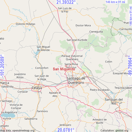
San Miguelito GPS coordinates[2]
20° 44' 13.524" North, 100° 30' 9.936" West
| Map corner | latitude | longitude |
|---|---|---|
| Upper-left | 21.39322°, | -101.20589° |
| Center: | 20.73709°, | -100.50276° |
| Lower-right: | 20.0781°, | -99.79964° |
| Map W x H: | 146.2×146.2 km | = 90.8×90.8mi |
| max Lat: | 32.7° ⇑27.7% North |
| San Miguelito: | 20.73709° |
| min Lat: | ⇓72.3% South 14.53588° |
| min Long | San Miguelito | max Long |
| -117.105° | -100.50276° | -86.73105° |
| W 30.5%⇐ | ⇒69.5% E |
Elevation
Elevation of San Miguelito is 2073 m = 6801 ft, and this is 819.3 m = 2688 ft above average elevation for this country.
| Max E: |
3497 m = 11473 ft | 22.8% |
| San Miguelito | 2073 m 6801 ft | |
| Avg. | 1253.7 m = 4113 ft | |
Min E: |
-1 m = -3 ft | 77.2% |
See also: Mexico elevation on elevation.city.
Geographical zone
San Miguelito is located in North Torrid zone (between Equator and Tropic of Cancer). Distance of this Northern Tropic circle is 300.2 km =186.5 mi to North.| Distance of | km | miles | from San Miguelito |
|---|---|---|---|
| North Pole | 7701.3 | 4785.4 | to North |
| Arctic Circle | 5095.4 | 3166.1 | to North |
| Tropic Cancer | 300.2 | 186.5 | to North |
| Equator | 2305.7 | 1432.7 | to South |


Nearby cities:
15 places around San Miguelito: (largest is in red/bold)
• Acequia Blanca
4.2 km =2.6 mi,  118°
118°
• Casa Blanca
1.7 km =1.1 mi,  351°
351°
• Cerro Colorado (El Colorado)
2.8 km =1.7 mi,  7°
7°
• El Nabo
5.3 km =3.3 mi,  154°
154°
• Estancia de la Rochera
3.8 km =2.4 mi, 352°
• Hacienda Santa Rosa [Fraccionamiento]
7.5 km =4.7 mi,  64°
64°
• Juriquilla
5.6 km =3.5 mi, 118°
• La Carbonera
7.6 km =4.7 mi,  358°
358°
• Mompaní
5 km =3.1 mi,  184°
184°
• Pie de Gallo
5.3 km =3.3 mi, 11°
• Rancho Largo
7.5 km =4.7 mi, 120°
• Rancho la Tinaja
6.5 km =4 mi,  246°
246°
• Santa Catarina
6.9 km =4.3 mi,  49°
49°
• Santa Rosa Jauregui
5.7 km =3.5 mi,  85°
85°
• Tlacote el Alto
5.6 km =3.5 mi,  205°
205°
Sources, notices
• [Note1] Compared only with cities in Mexico existing in our database
• [Src1] Map data: © OpenStreetMap contributors (CC-BY-SA)
• [Src2] Other city data from geonames.org with taken over terms of usage.
• [Src3] Geographical zone / Annual Mean Temperature by Robert A. Rohde @ Wikipedia
