Tamazula geodata
Tamazula (Guanajuato) is a populated place; located in Mexico in America/Mexico_City (GMT-6) time zone. With population of 1,261 people, there are 6866 cities with bigger population in this country. Compared to other cities in Mexico, 66.6% of cities are located further ↓South; 77.8% of cities are located further →East and 58.1% of cities have lower elevation than Tamazula. Note1


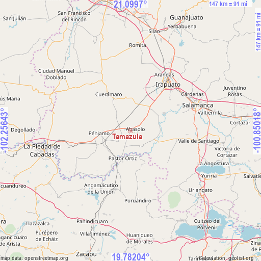
Tamazula GPS coordinates[2]
20° 26' 32.208" North, 101° 33' 11.88" West
| Map corner | latitude | longitude |
|---|---|---|
| Upper-left | 21.0997°, | -102.25643° |
| Center: | 20.44228°, | -101.5533° |
| Lower-right: | 19.78204°, | -100.85018° |
| Map W x H: | 146.5×146.5 km | = 91×91mi |
| max Lat: | 32.7° ⇑33.4% North |
| Tamazula: | 20.44228° |
| min Lat: | ⇓66.6% South 14.53588° |
| min Long | Tamazula | max Long |
| -117.105° | -101.5533° | -86.73105° |
| W 22.2%⇐ | ⇒77.8% E |
Elevation
Elevation of Tamazula is 1693 m = 5554 ft, and this is 439.3 m = 1441 ft above average elevation for this country.
| Max E: |
3497 m = 11473 ft | 41.9% |
| Tamazula | 1693 m 5554 ft | |
| Avg. | 1253.7 m = 4113 ft | |
Min E: |
-1 m = -3 ft | 58.1% |
See also: Mexico elevation on elevation.city.
Geographical zone
Tamazula is located in North Torrid zone (between Equator and Tropic of Cancer). Distance of this Northern Tropic circle is 333 km =206.9 mi to North.| Distance of | km | miles | from Tamazula |
|---|---|---|---|
| North Pole | 7734.1 | 4805.7 | to North |
| Arctic Circle | 5128.2 | 3186.5 | to North |
| Tropic Cancer | 333 | 206.9 | to North |
| Equator | 2273 | 1412.4 | to South |


Nearby cities:
15 places around Tamazula: (largest is in red/bold)
• Abasolo
2.5 km =1.6 mi,  70°
70°
• Concepción de Ruiz
9 km =5.6 mi,  226°
226°
• El Novillero
5.8 km =3.6 mi,  202°
202°
• Estación Abasolo
7.2 km =4.5 mi,  342°
342°
• Estación Corralejo
7.3 km =4.5 mi,  295°
295°
• Huitzatarito
5.8 km =3.6 mi, 341°
• La Tinaja de Negrete
9.4 km =5.8 mi,  81°
81°
• Ojos de Agua
6.2 km =3.9 mi, 197°
• Otates
8.8 km =5.5 mi,  121°
121°
• Purísima de Ramírez (Los Oriones)
9.1 km =5.7 mi,  263°
263°
• San Bernardo Peña Blanca
7.7 km =4.8 mi, 73°
• San Gabriel y San Ignacio
5.7 km =3.5 mi,  267°
267°
• San Isidro
6.6 km =4.1 mi, 68°
• San José de González
7.6 km =4.7 mi,  25°
25°
• San Juan Grande
7.8 km =4.8 mi,  159°
159°
Sources, notices
• [Note1] Compared only with cities in Mexico existing in our database
• [Src1] Map data: © OpenStreetMap contributors (CC-BY-SA)
• [Src2] Other city data from geonames.org with taken over terms of usage.
• [Src3] Geographical zone / Annual Mean Temperature by Robert A. Rohde @ Wikipedia
