San Gabriel y San Ignacio geodata
San Gabriel y San Ignacio (Guanajuato) is a populated place; located in Mexico in America/Mexico_City (GMT-6) time zone. With population of 1,147 people, there are 7562 cities with bigger population in this country. Compared to other cities in Mexico, 66.5% of cities are located further ↓South; 78.2% of cities are located further →East and 58% of cities have lower elevation than San Gabriel y San Ignacio. Note1
Current local time in San Gabriel y San Ignacio:
06:51 AM, WednesdayDifference from your time zone: hours


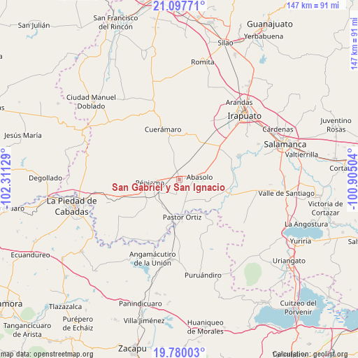
San Gabriel y San Ignacio GPS coordinates[2]
20° 26' 25.008" North, 101° 36' 29.376" West
| Map corner | latitude | longitude |
|---|---|---|
| Upper-left | 21.09771°, | -102.31129° |
| Center: | 20.44028°, | -101.60816° |
| Lower-right: | 19.78003°, | -100.90504° |
| Map W x H: | 146.5×146.5 km | = 91×91mi |
| max Lat: | 32.7° ⇑33.5% North |
| San Gabriel y San Ignacio: | 20.44028° |
| min Lat: | ⇓66.5% South 14.53588° |
| min Long | San Gabriel y S | max Long |
| -117.105° | -101.60816° | -86.73105° |
| W 21.8%⇐ | ⇒78.2% E |
Elevation
Elevation of San Gabriel y San Ignacio is 1691 m = 5548 ft, and this is 437.3 m = 1435 ft above average elevation for this country.
| Max E: |
3497 m = 11473 ft | 42% |
| San Gabriel y San Ignacio | 1691 m 5548 ft | |
| Avg. | 1253.7 m = 4113 ft | |
Min E: |
-1 m = -3 ft | 58% |
See also: Mexico elevation on elevation.city.
Geographical zone
San Gabriel y San Ignacio is located in North Torrid zone (between Equator and Tropic of Cancer). Distance of this Northern Tropic circle is 333.2 km =207 mi to North.| Distance of | km | miles | from San Gabriel y San Ignacio |
|---|---|---|---|
| North Pole | 7734.3 | 4805.9 | to North |
| Arctic Circle | 5128.4 | 3186.6 | to North |
| Tropic Cancer | 333.2 | 207 | to North |
| Equator | 2272.7 | 1412.2 | to South |


Nearby cities:
15 places around San Gabriel y San Ignacio: (largest is in red/bold)
• Abasolo
8.1 km =5 mi,  82°
82°
• Capilla de Marquéz
7.4 km =4.6 mi,  202°
202°
• Concepción de Ruiz
6 km =3.7 mi,  188°
188°
• Corralejo de Hidalgo
7.7 km =4.8 mi,  342°
342°
• El Novillero
6.2 km =3.9 mi,  145°
145°
• El Tule
9.7 km =6 mi,  6°
6°
• Estación Abasolo
8 km =5 mi,  26°
26°
• Estación Corralejo
3.4 km =2.1 mi,  345°
345°
• Huitzatarito
7 km =4.3 mi, 34°
• La Granjena
7.4 km =4.6 mi,  226°
226°
• Magallanes
9.6 km =6 mi,  285°
285°
• Ojos de Agua
6.9 km =4.3 mi, 145°
• Purísima de Ramírez (Los Oriones)
3.4 km =2.1 mi,  256°
256°
• Tamazula
5.7 km =3.5 mi,  87°
87°
• Zapote de Cestao
8.6 km =5.3 mi,  304°
304°
Sources, notices
• [Note1] Compared only with cities in Mexico existing in our database
• [Src1] Map data: © OpenStreetMap contributors (CC-BY-SA)
• [Src2] Other city data from geonames.org with taken over terms of usage.
• [Src3] Geographical zone / Annual Mean Temperature by Robert A. Rohde @ Wikipedia
