Santa María geodata
Santa María (Jalisco) is a populated place; located in Mexico in America/Mexico_City (GMT-6) time zone. With population of 588 people, there are 14598 cities with bigger population in this country. Compared to other cities in Mexico, 65.7% of cities are located further ↓South; 89.6% of cities are located further →East and 52.7% of cities have higher elevation than Santa María. Note1


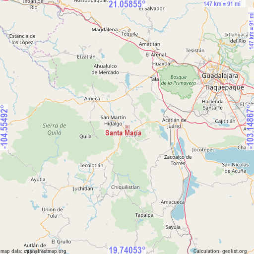
Santa María GPS coordinates[2]
20° 24' 3.42" North, 103° 51' 6.444" West
| Map corner | latitude | longitude |
|---|---|---|
| Upper-left | 21.05855°, | -104.55492° |
| Center: | 20.40095°, | -103.85179° |
| Lower-right: | 19.74053°, | -103.14867° |
| Map W x H: | 146.6×146.6 km | = 91.1×91.1mi |
| max Lat: | 32.7° ⇑34.3% North |
| Santa María: | 20.40095° |
| min Lat: | ⇓65.7% South 14.53588° |
| min Long | Santa María | max Long |
| -117.105° | -103.85179° | -86.73105° |
| W 10.4%⇐ | ⇒89.6% E |
Elevation
Elevation of Santa María is 1303 m = 4275 ft, and this is 49.3 m = 162 ft above average elevation for this country.
| Max E: |
3497 m = 11473 ft | 52.7% |
| Santa María | 1303 m 4275 ft | |
| Avg. | 1253.7 m = 4113 ft | |
Min E: |
-1 m = -3 ft | 47.3% |
See also: Mexico elevation on elevation.city.
Geographical zone
Santa María is located in North Torrid zone (between Equator and Tropic of Cancer). Distance of this Northern Tropic circle is 337.5 km =209.7 mi to North.| Distance of | km | miles | from Santa María |
|---|---|---|---|
| North Pole | 7738.7 | 4808.6 | to North |
| Arctic Circle | 5132.8 | 3189.4 | to North |
| Tropic Cancer | 337.5 | 209.7 | to North |
| Equator | 2268.4 | 1409.5 | to South |


Nearby cities:
15 places around Santa María: (largest is in red/bold)
• Buenavista
12.9 km =8 mi,  123°
123°
• Camichinas
12.2 km =7.6 mi,  25°
25°
• Cocula
5 km =3.1 mi,  142°
142°
• El Crucero de Santa María
2.2 km =1.4 mi,  206°
206°
• El Salitre
12.2 km =7.6 mi,  357°
357°
• Estipa
14.1 km =8.8 mi,  107°
107°
• Juan Gil Preciado
13.3 km =8.3 mi,  103°
103°
• La Estanzuela
8.7 km =5.4 mi, 355°
• La Sauceda
7.4 km =4.6 mi,  39°
39°
• Labor de Medina
11.7 km =7.3 mi,  316°
316°
• Los Guerrero
6.6 km =4.1 mi,  313°
313°
• San Martín Hidalgo
8.9 km =5.5 mi,  295°
295°
• San Nicolás
8.2 km =5.1 mi,  24°
24°
• Santa Cruz de las Flores
10.2 km =6.3 mi,  265°
265°
• Santa Teresa
11.1 km =6.9 mi, 140°
Sources, notices
• [Note1] Compared only with cities in Mexico existing in our database
• [Src1] Map data: © OpenStreetMap contributors (CC-BY-SA)
• [Src2] Other city data from geonames.org with taken over terms of usage.
• [Src3] Geographical zone / Annual Mean Temperature by Robert A. Rohde @ Wikipedia
