Buenavista Tomatlán geodata
Buenavista Tomatlán (Michoacán) is a populated place; located in Mexico in America/Mexico_City (GMT-6) time zone. With population of 10,390 people, there are 916 cities with bigger population in this country. Compared to other cities in Mexico, 60.9% of cities are located further ↑North; 84.4% of cities are located further →East and 69% of cities have higher elevation than Buenavista Tomatlán. Note1


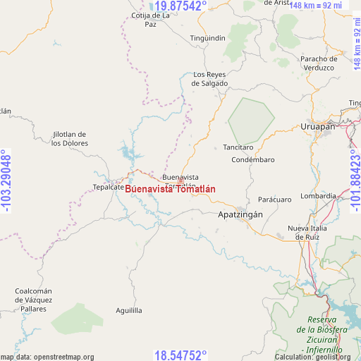
Buenavista Tomatlán GPS coordinates[2]
19° 12' 46.116" North, 102° 35' 14.46" West
| Map corner | latitude | longitude |
|---|---|---|
| Upper-left | 19.87542°, | -103.29048° |
| Center: | 19.21281°, | -102.58735° |
| Lower-right: | 18.54752°, | -101.88423° |
| Map W x H: | 147.6×147.7 km | = 91.7×91.8mi |
| max Lat: | 32.7° ⇑60.9% North |
| Buenavista Tomatlán: | 19.21281° |
| min Lat: | ⇓39.1% South 14.53588° |
| min Long | Buenavista Toma | max Long |
| -117.105° | -102.58735° | -86.73105° |
| W 15.6%⇐ | ⇒84.4% E |
Elevation
Elevation of Buenavista Tomatlán is 466 m = 1529 ft, and this is 787.7 m = 2584 ft below average elevation for this country.
| Max E: |
3497 m = 11473 ft | 69% |
| Avg. | 1253.7 m = 4113 ft | |
| Buenavista Tomatlán | 466 m = 1529 ft | |
Min E: |
-1 m = -3 ft | 31% |
See also: Mexico elevation on elevation.city.
Geographical zone
Buenavista Tomatlán is located in North Torrid zone (between Equator and Tropic of Cancer). Distance of this Northern Tropic circle is 469.7 km =291.9 mi to North.| Distance of | km | miles | from Buenavista Tomatlán |
|---|---|---|---|
| North Pole | 7870.8 | 4890.7 | to North |
| Arctic Circle | 5264.9 | 3271.5 | to North |
| Tropic Cancer | 469.7 | 291.9 | to North |
| Equator | 2136.3 | 1327.4 | to South |


Nearby cities:
15 places around Buenavista Tomatlán: (largest is in red/bold)
• Buenavistilla (La Garita)
14.6 km =9.1 mi,  197°
197°
• Cenobio Moreno
15.6 km =9.7 mi,  145°
145°
• Dieciocho de Marzo
12.6 km =7.8 mi,  279°
279°
• División del Norte
14.8 km =9.2 mi,  190°
190°
• El Terrero
19 km =11.8 mi, 199°
• Felipe Carrillo Puerto
13.8 km =8.6 mi,  246°
246°
• Pinzándaro
12.5 km =7.8 mi,  156°
156°
• Punta del Agua
15.5 km =9.6 mi,  212°
212°
• Páreo
19.5 km =12.1 mi,  46°
46°
• Rancho Nuevo
16.5 km =10.3 mi,  311°
311°
• San Juan De Los Platanos
17.7 km =11 mi,  118°
118°
• San Juan de los Plátanos
17.8 km =11.1 mi, 118°
• Santa Ana Amatlán
7.6 km =4.7 mi,  139°
139°
• Tazumbo
10.9 km =6.8 mi,  326°
326°
• Vicente Guerrero
16.1 km =10 mi, 162°
Sources, notices
• [Note1] Compared only with cities in Mexico existing in our database
• [Src1] Map data: © OpenStreetMap contributors (CC-BY-SA)
• [Src2] Other city data from geonames.org with taken over terms of usage.
• [Src3] Geographical zone / Annual Mean Temperature by Robert A. Rohde @ Wikipedia
