San Pedro Piedra Gorda geodata
San Pedro Piedra Gorda (Zacatecas) is a seat of a second-order administrative division; located in Mexico in America/Mexico_City (GMT-6) time zone. With population of 8,297 people, there are 1146 cities with bigger population in this country. Compared to other cities in Mexico, 86.5% of cities are located further ↓South; 83.2% of cities are located further →East and 74.7% of cities have lower elevation than San Pedro Piedra Gorda. Note1
Current local time in San Pedro Piedra Gorda:
06:45 AM, WednesdayDifference from your time zone: hours


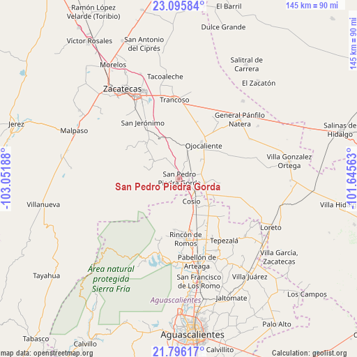
San Pedro Piedra Gorda GPS coordinates[2]
22° 26' 51.108" North, 102° 20' 55.5" West
| Map corner | latitude | longitude |
|---|---|---|
| Upper-left | 23.09584°, | -103.05188° |
| Center: | 22.44753°, | -102.34875° |
| Lower-right: | 21.79617°, | -101.64563° |
| Map W x H: | 144.5×144.5 km | = 89.8×89.8mi |
| max Lat: | 32.7° ⇑13.5% North |
| San Pedro Piedra Gorda: | 22.44753° |
| min Lat: | ⇓86.5% South 14.53588° |
| min Long | San Pedro Piedr | max Long |
| -117.105° | -102.34875° | -86.73105° |
| W 16.8%⇐ | ⇒83.2% E |
Elevation
Elevation of San Pedro Piedra Gorda is 2024 m = 6640 ft, and this is 770.3 m = 2527 ft above average elevation for this country.
| Max E: |
3497 m = 11473 ft | 25.3% |
| San Pedro Piedra Gorda | 2024 m 6640 ft | |
| Avg. | 1253.7 m = 4113 ft | |
Min E: |
-1 m = -3 ft | 74.7% |
See also: Mexico elevation on elevation.city.
Geographical zone
San Pedro Piedra Gorda is located in North Torrid zone (between Equator and Tropic of Cancer). Distance of this Northern Tropic circle is 110 km =68.4 mi to North.| Distance of | km | miles | from San Pedro Piedra Gorda |
|---|---|---|---|
| North Pole | 7511.1 | 4667.2 | to North |
| Arctic Circle | 4905.2 | 3047.9 | to North |
| Tropic Cancer | 110 | 68.4 | to North |
| Equator | 2495.9 | 1550.9 | to South |


Nearby cities:
15 places around San Pedro Piedra Gorda: (largest is in red/bold)
• Colonia Río Verde
8.9 km =5.5 mi,  289°
289°
• Colonia San Isidro
12.7 km =7.9 mi,  284°
284°
• Colonia Veinte de Noviembre
9.2 km =5.7 mi,  48°
48°
• Cosío
10.3 km =6.4 mi,  151°
151°
• El Refugio de Agua Zarca
12.2 km =7.6 mi,  142°
142°
• El Salero
7.2 km =4.5 mi,  158°
158°
• Esteban S. Castorena
9.2 km =5.7 mi,  79°
79°
• Genaro Codina
12 km =7.5 mi, 291°
• La Concepción
11.4 km =7.1 mi, 48°
• Luis Moya
10.4 km =6.5 mi,  99°
99°
• Piedra Gorda
6.9 km =4.3 mi,  14°
14°
• Rancho Nuevo
4.4 km =2.7 mi,  179°
179°
• Santa María de la Paz
11.5 km =7.1 mi,  125°
125°
• Soledad de Abajo
7.8 km =4.8 mi,  124°
124°
• Soledad de Arriba
4.6 km =2.9 mi,  111°
111°
Sources, notices
• [Note1] Compared only with cities in Mexico existing in our database
• [Src1] Map data: © OpenStreetMap contributors (CC-BY-SA)
• [Src2] Other city data from geonames.org with taken over terms of usage.
• [Src3] Geographical zone / Annual Mean Temperature by Robert A. Rohde @ Wikipedia
