Los López geodata
Los López (Guanajuato) is a populated place; located in Mexico in America/Mexico_City (GMT-6) time zone. With population of 641 people, there are 13506 cities with bigger population in this country. Compared to other cities in Mexico, 75.4% of cities are located further ↓South; 71.8% of cities are located further →East and 66.5% of cities have lower elevation than Los López. Note1


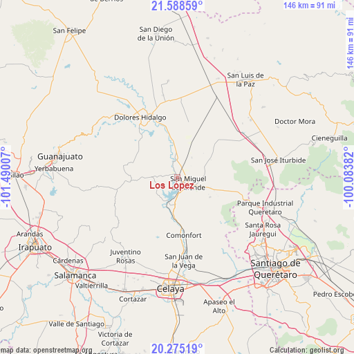
Los López GPS coordinates[2]
20° 55' 59.988" North, 100° 47' 12.984" West
| Map corner | latitude | longitude |
|---|---|---|
| Upper-left | 21.58859°, | -101.49007° |
| Center: | 20.93333°, | -100.78694° |
| Lower-right: | 20.27519°, | -100.08382° |
| Map W x H: | 146×146 km | = 90.7×90.7mi |
| max Lat: | 32.7° ⇑24.6% North |
| Los López: | 20.93333° |
| min Lat: | ⇓75.4% South 14.53588° |
| min Long | Los López | max Long |
| -117.105° | -100.78694° | -86.73105° |
| W 28.2%⇐ | ⇒71.8% E |
Elevation
Elevation of Los López is 1861 m = 6106 ft, and this is 607.3 m = 1992 ft above average elevation for this country.
| Max E: |
3497 m = 11473 ft | 33.5% |
| Los López | 1861 m 6106 ft | |
| Avg. | 1253.7 m = 4113 ft | |
Min E: |
-1 m = -3 ft | 66.5% |
See also: Mexico elevation on elevation.city.
Geographical zone
Los López is located in North Torrid zone (between Equator and Tropic of Cancer). Distance of this Northern Tropic circle is 278.4 km =173 mi to North.| Distance of | km | miles | from Los López |
|---|---|---|---|
| North Pole | 7679.5 | 4771.8 | to North |
| Arctic Circle | 5073.6 | 3152.6 | to North |
| Tropic Cancer | 278.4 | 173 | to North |
| Equator | 2327.6 | 1446.3 | to South |


Nearby cities:
15 places around Los López: (largest is in red/bold)
• Colonia San Luis Rey
5.3 km =3.3 mi,  87°
87°
• Esperanza
1.2 km =0.7 mi,  175°
175°
• Flores de Begoña
7.1 km =4.4 mi,  187°
187°
• Francisco Villa [Fraccionamiento]
5.6 km =3.5 mi,  84°
84°
• Insurgentes
5.2 km =3.2 mi, 82°
• La Cieneguita
1.5 km =0.9 mi,  348°
348°
• La Cruz del Palmar
7.1 km =4.4 mi,  304°
304°
• La Lomita
5.4 km =3.4 mi, 83°
• Lomas de San José
2.9 km =1.8 mi,  38°
38°
• Montes de Loreto
5.5 km =3.4 mi, 91°
• Nigromante
3.3 km =2.1 mi,  12°
12°
• San Miguel Viejo
2.9 km =1.8 mi,  166°
166°
• San Miguel de Allende
4.9 km =3 mi,  114°
114°
• Santa Cecilia
5.2 km =3.2 mi, 90°
• Santa Teresita de Don Diego
6 km =3.7 mi, 171°
Sources, notices
• [Note1] Compared only with cities in Mexico existing in our database
• [Src1] Map data: © OpenStreetMap contributors (CC-BY-SA)
• [Src2] Other city data from geonames.org with taken over terms of usage.
• [Src3] Geographical zone / Annual Mean Temperature by Robert A. Rohde @ Wikipedia
