San Miguel geodata
San Miguel (Jalisco) is a populated place; located in Mexico in America/Mexico_City (GMT-6) time zone. With population of 592 people, there are 14508 cities with bigger population in this country. Compared to other cities in Mexico, 50.2% of cities are located further ↑North; 91.5% of cities are located further →East and 71.6% of cities have higher elevation than San Miguel. Note1


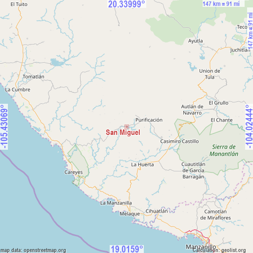
San Miguel GPS coordinates[2]
19° 40' 45.516" North, 104° 43' 39.216" West
| Map corner | latitude | longitude |
|---|---|---|
| Upper-left | 20.33999°, | -105.43069° |
| Center: | 19.67931°, | -104.72756° |
| Lower-right: | 19.0159°, | -104.02444° |
| Map W x H: | 147.2×147.2 km | = 91.5×91.5mi |
| max Lat: | 32.7° ⇑50.2% North |
| San Miguel: | 19.67931° |
| min Lat: | ⇓49.8% South 14.53588° |
| min Long | San Miguel | max Long |
| -117.105° | -104.72756° | -86.73105° |
| W 8.5%⇐ | ⇒91.5% E |
Elevation
Elevation of San Miguel is 342 m = 1122 ft, and this is 911.7 m = 2991 ft below average elevation for this country.
| Max E: |
3497 m = 11473 ft | 71.6% |
| Avg. | 1253.7 m = 4113 ft | |
| San Miguel | 342 m = 1122 ft | |
Min E: |
-1 m = -3 ft | 28.4% |
See also: Mexico elevation on elevation.city.
Geographical zone
San Miguel is located in North Torrid zone (between Equator and Tropic of Cancer). Distance of this Northern Tropic circle is 417.8 km =259.6 mi to North.| Distance of | km | miles | from San Miguel |
|---|---|---|---|
| North Pole | 7818.9 | 4858.4 | to North |
| Arctic Circle | 5213 | 3239.2 | to North |
| Tropic Cancer | 417.8 | 259.6 | to North |
| Equator | 2188.1 | 1359.6 | to South |


Nearby cities:
15 places around San Miguel: (largest is in red/bold)
• Apazulco (Miguel Hidalgo Viejo)
37.9 km =23.5 mi,  204°
204°
• Autlán de Navarro
39 km =24.2 mi,  75°
75°
• Coyamel (El Coyame)
29.4 km =18.3 mi,  133°
133°
• El Chico
22 km =13.7 mi, 125°
• Emiliano Zapata
41 km =25.5 mi,  217°
217°
• La Huerta
23.4 km =14.5 mi,  157°
157°
• La Resolana
31.8 km =19.8 mi,  105°
105°
• Las Juntas
27.7 km =17.2 mi,  175°
175°
• Lo Arado
21.2 km =13.2 mi, 107°
• Piedra Pesada
29.9 km =18.6 mi,  118°
118°
• Purificación
13.5 km =8.4 mi,  71°
71°
• San Mateo
39.2 km =24.4 mi,  253°
253°
• Tecomates
29.2 km =18.1 mi, 119°
• Tequesquitlán
39 km =24.2 mi,  146°
146°
• Zapotillo
30.4 km =18.9 mi,  99°
99°
Sources, notices
• [Note1] Compared only with cities in Mexico existing in our database
• [Src1] Map data: © OpenStreetMap contributors (CC-BY-SA)
• [Src2] Other city data from geonames.org with taken over terms of usage.
• [Src3] Geographical zone / Annual Mean Temperature by Robert A. Rohde @ Wikipedia
