San Juan Espanatica geodata
San Juan Espanatica (Jalisco) is a populated place; located in Mexico in America/Mexico_City (GMT-6) time zone. With population of 941 people, there are 9258 cities with bigger population in this country. Compared to other cities in Mexico, 54.1% of cities are located further ↑North; 87.8% of cities are located further →East and 57.7% of cities have higher elevation than San Juan Espanatica. Note1


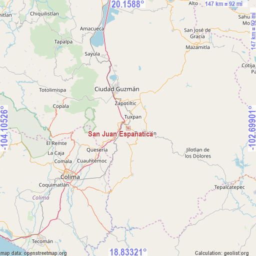
San Juan Espanatica GPS coordinates[2]
19° 29' 50.496" North, 103° 24' 7.668" West
| Map corner | latitude | longitude |
|---|---|---|
| Upper-left | 20.1588°, | -104.10526° |
| Center: | 19.49736°, | -103.40213° |
| Lower-right: | 18.83321°, | -102.69901° |
| Map W x H: | 147.4×147.4 km | = 91.6×91.6mi |
| max Lat: | 32.7° ⇑54.1% North |
| San Juan Espanatica: | 19.49736° |
| min Lat: | ⇓45.9% South 14.53588° |
| min Long | San Juan Espana | max Long |
| -117.105° | -103.40213° | -86.73105° |
| W 12.2%⇐ | ⇒87.8% E |
Elevation
Elevation of San Juan Espanatica is 1110 m = 3642 ft, and this is 143.7 m = 471 ft below average elevation for this country.
| Max E: |
3497 m = 11473 ft | 57.7% |
| Avg. | 1253.7 m = 4113 ft | |
| San Juan Espanatica | 1110 m = 3642 ft | |
Min E: |
-1 m = -3 ft | 42.3% |
See also: Mexico elevation on elevation.city.
Geographical zone
San Juan Espanatica is located in North Torrid zone (between Equator and Tropic of Cancer). Distance of this Northern Tropic circle is 438 km =272.2 mi to North.| Distance of | km | miles | from San Juan Espanatica |
|---|---|---|---|
| North Pole | 7839.2 | 4871.1 | to North |
| Arctic Circle | 5233.3 | 3251.8 | to North |
| Tropic Cancer | 438 | 272.2 | to North |
| Equator | 2167.9 | 1347.1 | to South |


Nearby cities:
15 places around San Juan Espanatica: (largest is in red/bold)
• Acueducto [Fraccionamiento]
9 km =5.6 mi,  102°
102°
• Atenquique
5.5 km =3.4 mi,  310°
310°
• Cofradía
17.1 km =10.6 mi,  245°
245°
• El Coahuayote (El Arco)
13.4 km =8.3 mi,  21°
21°
• El Pozo Santo (Crucero del Tule)
19.1 km =11.9 mi,  174°
174°
• El Rincón
18.9 km =11.7 mi,  359°
359°
• La Higuera
8.2 km =5.1 mi,  185°
185°
• La Mesa (El Fresnito)
18.3 km =11.4 mi,  319°
319°
• La Purísima
7.7 km =4.8 mi,  94°
94°
• San Marcos
12.3 km =7.6 mi,  242°
242°
• Tasinaxtla (La Cañada)
14.2 km =8.8 mi,  49°
49°
• Tecalitlán
10.3 km =6.4 mi,  105°
105°
• Tonila
13.9 km =8.6 mi, 239°
• Tuxpan
7 km =4.3 mi, 23°
• Zapotiltic
14.6 km =9.1 mi,  353°
353°
Sources, notices
• [Note1] Compared only with cities in Mexico existing in our database
• [Src1] Map data: © OpenStreetMap contributors (CC-BY-SA)
• [Src2] Other city data from geonames.org with taken over terms of usage.
• [Src3] Geographical zone / Annual Mean Temperature by Robert A. Rohde @ Wikipedia
