La Mesa (El Fresnito) geodata
La Mesa (El Fresnito) (Jalisco) is a populated place; located in Mexico in America/Mexico_City (GMT-6) time zone. With population of 851 people, there are 10275 cities with bigger population in this country. Compared to other cities in Mexico, 51.4% of cities are located further ↑North; 88.4% of cities are located further →East and 60.2% of cities have lower elevation than La Mesa (El Fresnito). Note1
Current local time in La Mesa (El Fresnito):
05:16 AM, WednesdayDifference from your time zone: hours


La Mesa (El Fresnito) GPS coordinates[2]
19° 37' 19.92" North, 103° 30' 59.688" West
| Map corner | latitude | longitude |
|---|---|---|
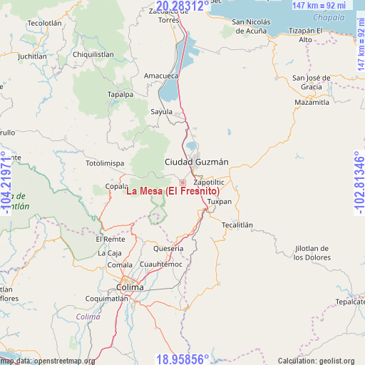
| Upper-left | 20.28312°, | -104.21971° |
| Center: | 19.6222°, | -103.51658° |
| Lower-right: | 18.95856°, | -102.81346° |
| Map W x H: | 147.3×147.3 km | = 91.5×91.5mi |
| max Lat: | 32.7° ⇑51.4% North |
| La Mesa (El Fresnito): | 19.6222° |
| min Lat: | ⇓48.6% South 14.53588° |
| min Long | La Mesa (El Fre | max Long |
| -117.105° | -103.51658° | -86.73105° |
| W 11.6%⇐ | ⇒88.4% E |
Elevation
Elevation of La Mesa (El Fresnito) is 1728 m = 5669 ft, and this is 474.3 m = 1556 ft above average elevation for this country.
| Max E: |
3497 m = 11473 ft | 39.8% |
| La Mesa (El Fresnito) | 1728 m 5669 ft | |
| Avg. | 1253.7 m = 4113 ft | |
Min E: |
-1 m = -3 ft | 60.2% |
See also: Mexico elevation on elevation.city.
Geographical zone
La Mesa (El Fresnito) is located in North Torrid zone (between Equator and Tropic of Cancer). Distance of this Northern Tropic circle is 424.1 km =263.5 mi to North.| Distance of | km | miles | from La Mesa (El Fresnito) |
|---|---|---|---|
| North Pole | 7825.3 | 4862.4 | to North |
| Arctic Circle | 5219.4 | 3243.2 | to North |
| Tropic Cancer | 424.1 | 263.5 | to North |
| Equator | 2181.8 | 1355.7 | to South |


Nearby cities:
15 places around La Mesa (El Fresnito): (largest is in red/bold)
• Atenquique
12.9 km =8 mi,  142°
142°
• Ciudad Guzmán
10.8 km =6.7 mi,  32°
32°
• Ciudad Guzmán [CERESO]
3.7 km =2.3 mi, 27°
• Cofradía
21.3 km =13.2 mi,  189°
189°
• El Coahuayote (El Arco)
16.9 km =10.5 mi,  94°
94°
• El Jazmín
20.6 km =12.8 mi,  279°
279°
• El Rincón
13 km =8.1 mi,  67°
67°
• Gómez Farías
19.5 km =12.1 mi,  12°
12°
• San Juan Espanatica
18.3 km =11.4 mi, 139°
• San Marcos
19.6 km =12.2 mi,  176°
176°
• San Sebastián del Sur
19.7 km =12.2 mi, 13°
• Tonila
21 km =13 mi, 179°
• Tuxpan
16.5 km =10.3 mi,  116°
116°
• Vista Hermosa
20.2 km =12.6 mi, 66°
• Zapotiltic
10.4 km =6.5 mi, 86°
Sources, notices
• [Note1] Compared only with cities in Mexico existing in our database
• [Src1] Map data: © OpenStreetMap contributors (CC-BY-SA)
• [Src2] Other city data from geonames.org with taken over terms of usage.
• [Src3] Geographical zone / Annual Mean Temperature by Robert A. Rohde @ Wikipedia
