Magallanes geodata
Magallanes (Guanajuato) is a populated place; located in Mexico in America/Mexico_City (GMT-6) time zone. With population of 841 people, there are 10405 cities with bigger population in this country. Compared to other cities in Mexico, 67% of cities are located further ↓South; 79% of cities are located further →East and 65.2% of cities have lower elevation than Magallanes. Note1


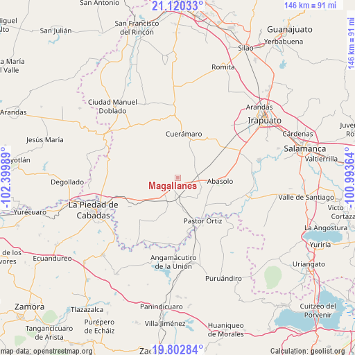
Magallanes GPS coordinates[2]
20° 27' 46.8" North, 101° 41' 48.336" West
| Map corner | latitude | longitude |
|---|---|---|
| Upper-left | 21.12033°, | -102.39989° |
| Center: | 20.463°, | -101.69676° |
| Lower-right: | 19.80284°, | -100.99364° |
| Map W x H: | 146.5×146.5 km | = 91×91mi |
| max Lat: | 32.7° ⇑33% North |
| Magallanes: | 20.463° |
| min Lat: | ⇓67% South 14.53588° |
| min Long | Magallanes | max Long |
| -117.105° | -101.69676° | -86.73105° |
| W 21%⇐ | ⇒79% E |
Elevation
Elevation of Magallanes is 1834 m = 6017 ft, and this is 580.3 m = 1904 ft above average elevation for this country.
| Max E: |
3497 m = 11473 ft | 34.8% |
| Magallanes | 1834 m 6017 ft | |
| Avg. | 1253.7 m = 4113 ft | |
Min E: |
-1 m = -3 ft | 65.2% |
See also: Mexico elevation on elevation.city.
Geographical zone
Magallanes is located in North Torrid zone (between Equator and Tropic of Cancer). Distance of this Northern Tropic circle is 330.6 km =205.4 mi to North.| Distance of | km | miles | from Magallanes |
|---|---|---|---|
| North Pole | 7731.8 | 4804.3 | to North |
| Arctic Circle | 5125.9 | 3185.1 | to North |
| Tropic Cancer | 330.6 | 205.4 | to North |
| Equator | 2275.3 | 1413.8 | to South |


Nearby cities:
15 places around Magallanes: (largest is in red/bold)
• Churipitzeo
7.4 km =4.6 mi,  219°
219°
• Corralejo de Hidalgo
8.4 km =5.2 mi,  55°
55°
• El Pedregal de Arriba
7 km =4.3 mi,  188°
188°
• El Volantín
9.1 km =5.7 mi,  256°
256°
• Estación Corralejo
8.4 km =5.2 mi,  84°
84°
• Estación Pénjamo
7.6 km =4.7 mi,  176°
176°
• Guangüitiro
8.4 km =5.2 mi,  254°
254°
• La Granjena
8.6 km =5.3 mi,  152°
152°
• La Troja (El Chiflido)
9.2 km =5.7 mi,  171°
171°
• Purísima de Ramírez (Los Oriones)
6.8 km =4.2 mi,  119°
119°
• Pénjamo
4.5 km =2.8 mi, 217°
• Rancho Seco de Barajas
11.2 km =7 mi, 175°
• San Gabriel y San Ignacio
9.6 km =6 mi,  105°
105°
• Zapote de Barajas
9.7 km =6 mi, 181°
• Zapote de Cestao
3.2 km =2 mi,  43°
43°
Sources, notices
• [Note1] Compared only with cities in Mexico existing in our database
• [Src1] Map data: © OpenStreetMap contributors (CC-BY-SA)
• [Src2] Other city data from geonames.org with taken over terms of usage.
• [Src3] Geographical zone / Annual Mean Temperature by Robert A. Rohde @ Wikipedia
