Zapote de Cestao geodata
Zapote de Cestao (Guanajuato) is a populated place; located in Mexico in America/Mexico_City (GMT-6) time zone. With population of 1,125 people, there are 7707 cities with bigger population in this country. Compared to other cities in Mexico, 67.4% of cities are located further ↓South; 78.8% of cities are located further →East and 64.5% of cities have lower elevation than Zapote de Cestao. Note1


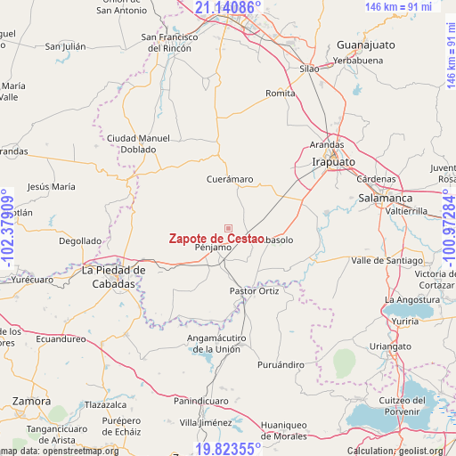
Zapote de Cestao GPS coordinates[2]
20° 29' 1.032" North, 101° 40' 33.456" West
| Map corner | latitude | longitude |
|---|---|---|
| Upper-left | 21.14086°, | -102.37909° |
| Center: | 20.48362°, | -101.67596° |
| Lower-right: | 19.82355°, | -100.97284° |
| Map W x H: | 146.5×146.5 km | = 91×91mi |
| max Lat: | 32.7° ⇑32.6% North |
| Zapote de Cestao: | 20.48362° |
| min Lat: | ⇓67.4% South 14.53588° |
| min Long | Zapote de Cesta | max Long |
| -117.105° | -101.67596° | -86.73105° |
| W 21.2%⇐ | ⇒78.8% E |
Elevation
Elevation of Zapote de Cestao is 1813 m = 5948 ft, and this is 559.3 m = 1835 ft above average elevation for this country.
| Max E: |
3497 m = 11473 ft | 35.5% |
| Zapote de Cestao | 1813 m 5948 ft | |
| Avg. | 1253.7 m = 4113 ft | |
Min E: |
-1 m = -3 ft | 64.5% |
See also: Mexico elevation on elevation.city.
Geographical zone
Zapote de Cestao is located in North Torrid zone (between Equator and Tropic of Cancer). Distance of this Northern Tropic circle is 328.4 km =204.1 mi to North.| Distance of | km | miles | from Zapote de Cestao |
|---|---|---|---|
| North Pole | 7729.5 | 4802.9 | to North |
| Arctic Circle | 5123.6 | 3183.7 | to North |
| Tropic Cancer | 328.4 | 204.1 | to North |
| Equator | 2277.6 | 1415.2 | to South |


Nearby cities:
15 places around Zapote de Cestao: (largest is in red/bold)
• Churipitzeo
10.5 km =6.5 mi,  220°
220°
• Corralejo de Hidalgo
5.3 km =3.3 mi,  62°
62°
• El Pedregal de Arriba
9.8 km =6.1 mi,  198°
198°
• El Tule
9.5 km =5.9 mi, 59°
• Estación Abasolo
10.9 km =6.8 mi,  77°
77°
• Estación Corralejo
6.4 km =4 mi,  103°
103°
• Estación Pénjamo
10 km =6.2 mi,  189°
189°
• Guangüitiro
11.2 km =7 mi,  245°
245°
• Huitzatarito
11 km =6.8 mi,  85°
85°
• La Granjena
10.1 km =6.3 mi,  170°
170°
• Magallanes
3.2 km =2 mi, 223°
• Purísima de Ramírez (Los Oriones)
6.8 km =4.2 mi,  146°
146°
• Pénjamo
7.6 km =4.7 mi, 219°
• San Gabriel y San Ignacio
8.6 km =5.3 mi,  124°
124°
• San Gregorio
8.6 km =5.3 mi,  35°
35°
Sources, notices
• [Note1] Compared only with cities in Mexico existing in our database
• [Src1] Map data: © OpenStreetMap contributors (CC-BY-SA)
• [Src2] Other city data from geonames.org with taken over terms of usage.
• [Src3] Geographical zone / Annual Mean Temperature by Robert A. Rohde @ Wikipedia
