Conchos geodata
Conchos (Chihuahua) is a seat of a second-order administrative division; located in Mexico in America/Chihuahua (GMT-6) time zone. With population of 644 people, there are 13427 cities with bigger population in this country. Compared to other cities in Mexico, 97% of cities are located further ↓South; 92.8% of cities are located further →East and 53.9% of cities have higher elevation than Conchos. Note1


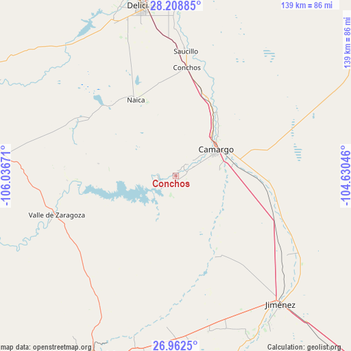
Conchos GPS coordinates[2]
27° 35' 14.82" North, 105° 20' 0.888" West
| Map corner | latitude | longitude |
|---|---|---|
| Upper-left | 28.20885°, | -106.03671° |
| Center: | 27.58745°, | -105.33358° |
| Lower-right: | 26.9625°, | -104.63046° |
| Map W x H: | 138.6×138.6 km | = 86.1×86.1mi |
| max Lat: | 32.7° ⇑3% North |
| Conchos: | 27.58745° |
| min Lat: | ⇓97% South 14.53588° |
| min Long | Conchos | max Long |
| -117.105° | -105.33358° | -86.73105° |
| W 7.2%⇐ | ⇒92.8% E |
Elevation
Elevation of Conchos is 1251 m = 4104 ft, and this is 2.7 m = 9 ft below average elevation for this country.
| Max E: |
3497 m = 11473 ft | 53.9% |
| Avg. | 1253.7 m = 4113 ft | |
| Conchos | 1251 m = 4104 ft | |
Min E: |
-1 m = -3 ft | 46.1% |
See also: Mexico elevation on elevation.city.
Geographical zone
Conchos is located in North temperate zone (between Tropic of Cancer and the Arctic Circle). Distance of this Northern Tropic circle is 461.5 km =286.8 mi to South.| Distance of | km | miles | from Conchos |
|---|---|---|---|
| North Pole | 6939.6 | 4312.1 | to North |
| Arctic Circle | 4333.7 | 2692.8 | to North |
| Tropic Cancer | 461.5 | 286.8 | to South |
| Equator | 3067.4 | 1906 | to South |


Nearby cities:
15 places around Conchos: (largest is in red/bold)
• Alta Vista
19.7 km =12.2 mi,  42°
42°
• Boquilla de Babisas (La Boquilla de Conchos)
8.1 km =5 mi,  237°
237°
• Camargo
18.9 km =11.7 mi,  57°
57°
• Corraleño
29.7 km =18.5 mi,  33°
33°
• Estación Conchos
43.1 km =26.8 mi,  5°
5°
• Estación Saucillo
48.7 km =30.3 mi,  1°
1°
• Estación la Cruz
30.1 km =18.7 mi, 28°
• La Cruz
33.6 km =20.9 mi,  23°
23°
• Naica
33.8 km =21 mi,  332°
332°
• Parritas
45.7 km =28.4 mi, 12°
• San Ignacio
23 km =14.3 mi, 38°
• Santa Gertrudis (La Hacienda)
44.4 km =27.6 mi,  298°
298°
• Saucillo
49.4 km =30.7 mi, 4°
• Valle de Zaragoza
49.2 km =30.6 mi,  252°
252°
• Valle del Toro
42.6 km =26.5 mi, 14°
Sources, notices
• [Note1] Compared only with cities in Mexico existing in our database
• [Src1] Map data: © OpenStreetMap contributors (CC-BY-SA)
• [Src2] Other city data from geonames.org with taken over terms of usage.
• [Src3] Geographical zone / Annual Mean Temperature by Robert A. Rohde @ Wikipedia
