San Ignacio geodata
San Ignacio (Chihuahua) is a populated place; located in Mexico in America/Chihuahua (GMT-6) time zone. With population of 576 people, there are 14877 cities with bigger population in this country. Compared to other cities in Mexico, 97.1% of cities are located further ↓South; 92.3% of cities are located further →East and 54.4% of cities have higher elevation than San Ignacio. Note1


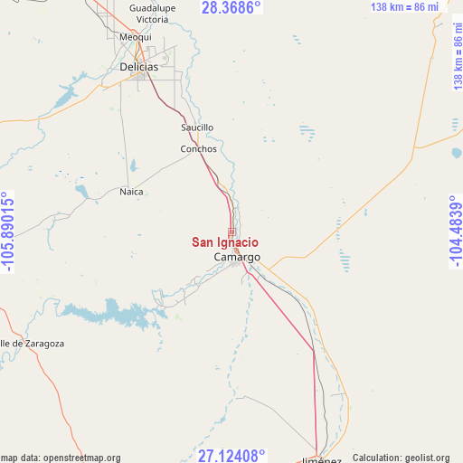
San Ignacio GPS coordinates[2]
27° 44' 53.232" North, 105° 11' 13.272" West
| Map corner | latitude | longitude |
|---|---|---|
| Upper-left | 28.3686°, | -105.89015° |
| Center: | 27.74812°, | -105.18702° |
| Lower-right: | 27.12408°, | -104.4839° |
| Map W x H: | 138.4×138.4 km | = 86×86mi |
| max Lat: | 32.7° ⇑2.9% North |
| San Ignacio: | 27.74812° |
| min Lat: | ⇓97.1% South 14.53588° |
| min Long | San Ignacio | max Long |
| -117.105° | -105.18702° | -86.73105° |
| W 7.7%⇐ | ⇒92.3% E |
Elevation
Elevation of San Ignacio is 1224 m = 4016 ft, and this is 29.7 m = 97 ft below average elevation for this country.
| Max E: |
3497 m = 11473 ft | 54.4% |
| Avg. | 1253.7 m = 4113 ft | |
| San Ignacio | 1224 m = 4016 ft | |
Min E: |
-1 m = -3 ft | 45.6% |
See also: Mexico elevation on elevation.city.
Geographical zone
San Ignacio is located in North temperate zone (between Tropic of Cancer and the Arctic Circle). Distance of this Northern Tropic circle is 479.4 km =297.9 mi to South.| Distance of | km | miles | from San Ignacio |
|---|---|---|---|
| North Pole | 6921.8 | 4301 | to North |
| Arctic Circle | 4315.9 | 2681.8 | to North |
| Tropic Cancer | 479.4 | 297.9 | to South |
| Equator | 3085.3 | 1917.1 | to South |


Nearby cities:
15 places around San Ignacio: (largest is in red/bold)
• Alta Vista
3.5 km =2.2 mi,  197°
197°
• Boquilla de Babisas (La Boquilla de Conchos)
30.8 km =19.1 mi,  223°
223°
• Camargo
7.9 km =4.9 mi,  168°
168°
• Colonia Vicente Guerrero
34.2 km =21.3 mi,  338°
338°
• Conchos
23 km =14.3 mi, 218°
• Corraleño
7.3 km =4.5 mi,  14°
14°
• Estación Conchos
26.9 km =16.7 mi, 338°
• Estación Saucillo
33.4 km =20.8 mi, 337°
• Estación la Cruz
8.7 km =5.4 mi,  359°
359°
• La Cruz
12.9 km =8 mi, 356°
• Loma Chica
43.7 km =27.2 mi, 339°
• Naica
32.4 km =20.1 mi,  292°
292°
• Parritas
27.2 km =16.9 mi,  350°
350°
• Saucillo
33.1 km =20.6 mi, 341°
• Valle del Toro
23.7 km =14.7 mi, 350°
Sources, notices
• [Note1] Compared only with cities in Mexico existing in our database
• [Src1] Map data: © OpenStreetMap contributors (CC-BY-SA)
• [Src2] Other city data from geonames.org with taken over terms of usage.
• [Src3] Geographical zone / Annual Mean Temperature by Robert A. Rohde @ Wikipedia
