San Bernardo geodata
San Bernardo (Sonora) is a populated place; located in Mexico in America/Hermosillo (GMT-7) time zone. With population of 1,067 people, there are 8174 cities with bigger population in this country. Compared to other cities in Mexico, 96.8% of cities are located further ↓South; 96.7% of cities are located further →East and 75.3% of cities have higher elevation than San Bernardo. Note1


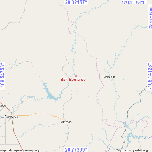
San Bernardo GPS coordinates[2]
27° 23' 56.724" North, 108° 50' 39.84" West
| Map corner | latitude | longitude |
|---|---|---|
| Upper-left | 28.02157°, | -109.54753° |
| Center: | 27.39909°, | -108.8444° |
| Lower-right: | 26.77309°, | -108.14128° |
| Map W x H: | 138.8×138.8 km | = 86.2×86.2mi |
| max Lat: | 32.7° ⇑3.2% North |
| San Bernardo: | 27.39909° |
| min Lat: | ⇓96.8% South 14.53588° |
| min Long | San Bernardo | max Long |
| -117.105° | -108.8444° | -86.73105° |
| W 3.3%⇐ | ⇒96.7% E |
Elevation
Elevation of San Bernardo is 210 m = 689 ft, and this is 1043.7 m = 3424 ft below average elevation for this country.
| Max E: |
3497 m = 11473 ft | 75.3% |
| Avg. | 1253.7 m = 4113 ft | |
| San Bernardo | 210 m = 689 ft | |
Min E: |
-1 m = -3 ft | 24.7% |
See also: Mexico elevation on elevation.city.
Geographical zone
San Bernardo is located in North temperate zone (between Tropic of Cancer and the Arctic Circle). Distance of this Northern Tropic circle is 440.6 km =273.8 mi to South.| Distance of | km | miles | from San Bernardo |
|---|---|---|---|
| North Pole | 6960.6 | 4325.1 | to North |
| Arctic Circle | 4354.7 | 2705.9 | to North |
| Tropic Cancer | 440.6 | 273.8 | to South |
| Equator | 3046.5 | 1893 | to South |


Nearby cities:
15 places around San Bernardo: (largest is in red/bold)
• Batacosa
56.9 km =35.4 mi,  284°
284°
• Buiyacusi
64.1 km =39.8 mi,  244°
244°
• Capohuiza
66.7 km =41.4 mi, 243°
• Chibucú
63.2 km =39.3 mi, 240°
• Chínipas
30.3 km =18.8 mi,  90°
90°
• El Mocúzarit (Conicárit)
32.3 km =20.1 mi,  230°
230°
• Guaymitas
66.9 km =41.6 mi, 241°
• Loma del Refugio
68.1 km =42.3 mi, 243°
• Los Tanques
21.5 km =13.4 mi,  193°
193°
• Milpillas
29.2 km =18.1 mi,  137°
137°
• Quiriego
42.4 km =26.3 mi,  288°
288°
• Rosales
65.7 km =40.8 mi, 243°
• Tierra Blanca
54.8 km =34.1 mi, 244°
• Témoris
57.5 km =35.7 mi,  103°
103°
• Álamos
42.7 km =26.5 mi, 192°
Sources, notices
• [Note1] Compared only with cities in Mexico existing in our database
• [Src1] Map data: © OpenStreetMap contributors (CC-BY-SA)
• [Src2] Other city data from geonames.org with taken over terms of usage.
• [Src3] Geographical zone / Annual Mean Temperature by Robert A. Rohde @ Wikipedia
