Los Tanques geodata
Los Tanques (Sonora) is a populated place; located in Mexico in America/Hermosillo (GMT-7) time zone. With population of 621 people, there are 13905 cities with bigger population in this country. Compared to other cities in Mexico, 96.6% of cities are located further ↓South; 96.8% of cities are located further →East and 72.5% of cities have higher elevation than Los Tanques. Note1


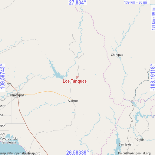
Los Tanques GPS coordinates[2]
27° 12' 37.62" North, 108° 53' 39.48" West
| Map corner | latitude | longitude |
|---|---|---|
| Upper-left | 27.834°, | -109.59743° |
| Center: | 27.21045°, | -108.8943° |
| Lower-right: | 26.58339°, | -108.19118° |
| Map W x H: | 139.1×139.1 km | = 86.4×86.4mi |
| max Lat: | 32.7° ⇑3.4% North |
| Los Tanques: | 27.21045° |
| min Lat: | ⇓96.6% South 14.53588° |
| min Long | Los Tanques | max Long |
| -117.105° | -108.8943° | -86.73105° |
| W 3.2%⇐ | ⇒96.8% E |
Elevation
Elevation of Los Tanques is 311 m = 1020 ft, and this is 942.7 m = 3093 ft below average elevation for this country.
| Max E: |
3497 m = 11473 ft | 72.5% |
| Avg. | 1253.7 m = 4113 ft | |
| Los Tanques | 311 m = 1020 ft | |
Min E: |
-1 m = -3 ft | 27.5% |
See also: Mexico elevation on elevation.city.
Geographical zone
Los Tanques is located in North temperate zone (between Tropic of Cancer and the Arctic Circle). Distance of this Northern Tropic circle is 419.6 km =260.7 mi to South.| Distance of | km | miles | from Los Tanques |
|---|---|---|---|
| North Pole | 6981.5 | 4338.1 | to North |
| Arctic Circle | 4375.7 | 2718.9 | to North |
| Tropic Cancer | 419.6 | 260.7 | to South |
| Equator | 3025.5 | 1880 | to South |


Nearby cities:
15 places around Los Tanques: (largest is in red/bold)
• Buiyacusi
53.3 km =33.1 mi,  262°
262°
• Capohuiza
55.5 km =34.5 mi, 260°
• Chibucú
51 km =31.7 mi, 258°
• Chínipas
40.8 km =25.4 mi,  59°
59°
• El Mocúzarit (Conicárit)
20 km =12.4 mi,  271°
271°
• Guaymitas
55 km =34.2 mi, 258°
• Loma del Refugio
56.7 km =35.2 mi, 260°
• Los Bahuises
57.6 km =35.8 mi, 259°
• Milpillas
24.7 km =15.3 mi,  91°
91°
• Navojoa
56.6 km =35.2 mi,  254°
254°
• Quiriego
49.3 km =30.6 mi,  314°
314°
• Rosales
54.5 km =33.9 mi, 260°
• San Bernardo
21.5 km =13.4 mi,  13°
13°
• Tierra Blanca
44.7 km =27.8 mi, 266°
• Álamos
21.2 km =13.2 mi,  190°
190°
Sources, notices
• [Note1] Compared only with cities in Mexico existing in our database
• [Src1] Map data: © OpenStreetMap contributors (CC-BY-SA)
• [Src2] Other city data from geonames.org with taken over terms of usage.
• [Src3] Geographical zone / Annual Mean Temperature by Robert A. Rohde @ Wikipedia
