Chibucú geodata
Chibucú (Sonora) is a populated place; located in Mexico in America/Hermosillo (GMT-7) time zone. With population of 558 people, there are 15286 cities with bigger population in this country. Compared to other cities in Mexico, 96.5% of cities are located further ↓South; 97.4% of cities are located further →East and 84.7% of cities have higher elevation than Chibucú. Note1


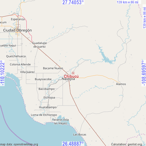
Chibucú GPS coordinates[2]
27° 6' 59.22" North, 109° 23' 56.724" West
| Map corner | latitude | longitude |
|---|---|---|
| Upper-left | 27.74053°, | -110.10222° |
| Center: | 27.11645°, | -109.39909° |
| Lower-right: | 26.48887°, | -108.69597° |
| Map W x H: | 139.2×139.2 km | = 86.5×86.5mi |
| max Lat: | 32.7° ⇑3.5% North |
| Chibucú: | 27.11645° |
| min Lat: | ⇓96.5% South 14.53588° |
| min Long | Chibucú | max Long |
| -117.105° | -109.39909° | -86.73105° |
| W 2.6%⇐ | ⇒97.4% E |
Elevation
Elevation of Chibucú is 46 m = 151 ft, and this is 1207.7 m = 3962 ft below average elevation for this country.
| Max E: |
3497 m = 11473 ft | 84.7% |
| Avg. | 1253.7 m = 4113 ft | |
| Chibucú | 46 m = 151 ft | |
Min E: |
-1 m = -3 ft | 15.3% |
See also: Mexico elevation on elevation.city.
Geographical zone
Chibucú is located in North temperate zone (between Tropic of Cancer and the Arctic Circle). Distance of this Northern Tropic circle is 409.1 km =254.2 mi to South.| Distance of | km | miles | from Chibucú |
|---|---|---|---|
| North Pole | 6992 | 4344.6 | to North |
| Arctic Circle | 4386.1 | 2725.4 | to North |
| Tropic Cancer | 409.1 | 254.2 | to South |
| Equator | 3015.1 | 1873.5 | to South |


Nearby cities:
15 places around Chibucú: (largest is in red/bold)
• Aquichopo
16.6 km =10.3 mi,  254°
254°
• Buiyacusi
4.6 km =2.9 mi,  320°
320°
• Capohuiza
5.2 km =3.2 mi,  289°
289°
• Chinotahueca
16.6 km =10.3 mi,  232°
232°
• El Recodo
13.4 km =8.3 mi, 251°
• El Siviral (Jigica)
10.2 km =6.3 mi,  261°
261°
• Guaymitas
3.9 km =2.4 mi, 259°
• Loma del Refugio
6 km =3.7 mi,  275°
275°
• Los Bahuises
6.7 km =4.2 mi,  270°
270°
• Navojoa
6.8 km =4.2 mi,  220°
220°
• Pueblo Mayo
18.2 km =11.3 mi,  302°
302°
• Rancho Camargo
13.1 km =8.1 mi, 262°
• Rosales
4.3 km =2.7 mi, 295°
• Siviral
10.4 km =6.5 mi, 260°
• Tierra Blanca
9.6 km =6 mi,  33°
33°
Sources, notices
• [Note1] Compared only with cities in Mexico existing in our database
• [Src1] Map data: © OpenStreetMap contributors (CC-BY-SA)
• [Src2] Other city data from geonames.org with taken over terms of usage.
• [Src3] Geographical zone / Annual Mean Temperature by Robert A. Rohde @ Wikipedia
