San Antonio de Peñuelas geodata
San Antonio de Peñuelas (Aguascalientes) is a populated place; located in Mexico in America/Mexico_City (GMT-6) time zone. With population of 2,147 people, there are 4087 cities with bigger population in this country. Compared to other cities in Mexico, 82.3% of cities are located further ↓South; 82.8% of cities are located further →East and 65.2% of cities have lower elevation than San Antonio de Peñuelas. Note1
Current local time in San Antonio de Peñuelas:
10:02 AM, MondayDifference from your time zone: hours


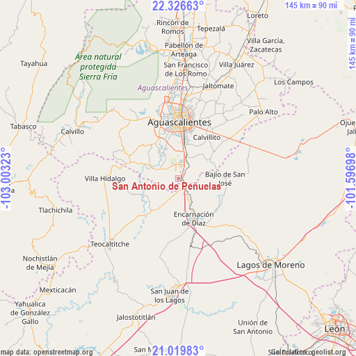
San Antonio de Peñuelas GPS coordinates[2]
21° 40' 28.956" North, 102° 18' 0.36" West
| Map corner | latitude | longitude |
|---|---|---|
| Upper-left | 22.32663°, | -103.00323° |
| Center: | 21.67471°, | -102.3001° |
| Lower-right: | 21.01983°, | -101.59698° |
| Map W x H: | 145.3×145.3 km | = 90.3×90.3mi |
| max Lat: | 32.7° ⇑17.7% North |
| San Antonio de Peñuelas: | 21.67471° |
| min Lat: | ⇓82.3% South 14.53588° |
| min Long | San Antonio de | max Long |
| -117.105° | -102.3001° | -86.73105° |
| W 17.2%⇐ | ⇒82.8% E |
Elevation
Elevation of San Antonio de Peñuelas is 1834 m = 6017 ft, and this is 580.3 m = 1904 ft above average elevation for this country.
| Max E: |
3497 m = 11473 ft | 34.8% |
| San Antonio de Peñuelas | 1834 m 6017 ft | |
| Avg. | 1253.7 m = 4113 ft | |
Min E: |
-1 m = -3 ft | 65.2% |
See also: Mexico elevation on elevation.city.
Geographical zone
San Antonio de Peñuelas is located in North Torrid zone (between Equator and Tropic of Cancer). Distance of this Northern Tropic circle is 195.9 km =121.7 mi to North.| Distance of | km | miles | from San Antonio de Peñuelas |
|---|---|---|---|
| North Pole | 7597.1 | 4720.6 | to North |
| Arctic Circle | 4991.2 | 3101.4 | to North |
| Tropic Cancer | 195.9 | 121.7 | to North |
| Equator | 2410 | 1497.5 | to South |


Nearby cities:
15 places around San Antonio de Peñuelas: (largest is in red/bold)
• Arellano
14.3 km =8.9 mi,  10°
10°
• Bajío de San José
19 km =11.8 mi,  89°
89°
• Buenavista de Peñuelas
4.8 km =3 mi, 5°
• Cieneguilla
17.2 km =10.7 mi,  292°
292°
• Cotorina
9.2 km =5.7 mi,  21°
21°
• El Refugio de Peñuelas
4.8 km =3 mi, 13°
• El Salvador
9.2 km =5.7 mi,  151°
151°
• El Tanque de los Jiménez
8.5 km =5.3 mi,  296°
296°
• Encarnación de Díaz
17.5 km =10.9 mi,  159°
159°
• Las Güeras
20.2 km =12.6 mi,  75°
75°
• Mesón de los Sauces
20.1 km =12.5 mi,  123°
123°
• Montoro
9 km =5.6 mi,  358°
358°
• Peñuelas (El Cienegal)
5.9 km =3.7 mi,  25°
25°
• San Sebastián [Fraccionamiento]
16.6 km =10.3 mi, 10°
• Villas del Mediterráneo
19 km =11.8 mi,  350°
350°
Sources, notices
• [Note1] Compared only with cities in Mexico existing in our database
• [Src1] Map data: © OpenStreetMap contributors (CC-BY-SA)
• [Src2] Other city data from geonames.org with taken over terms of usage.
• [Src3] Geographical zone / Annual Mean Temperature by Robert A. Rohde @ Wikipedia
