El Refugio de Peñuelas geodata
El Refugio de Peñuelas (Aguascalientes) is a populated place; located in Mexico in America/Mexico_City (GMT-6) time zone. With population of 1,624 people, there are 5327 cities with bigger population in this country. Compared to other cities in Mexico, 82.5% of cities are located further ↓South; 82.7% of cities are located further →East and 66.7% of cities have lower elevation than El Refugio de Peñuelas. Note1


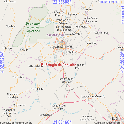
El Refugio de Peñuelas GPS coordinates[2]
21° 42' 58.86" North, 102° 17' 21.876" West
| Map corner | latitude | longitude |
|---|---|---|
| Upper-left | 22.36808°, | -102.99254° |
| Center: | 21.71635°, | -102.28941° |
| Lower-right: | 21.06166°, | -101.58629° |
| Map W x H: | 145.3×145.3 km | = 90.3×90.3mi |
| max Lat: | 32.7° ⇑17.5% North |
| El Refugio de Peñuelas: | 21.71635° |
| min Lat: | ⇓82.5% South 14.53588° |
| min Long | El Refugio de P | max Long |
| -117.105° | -102.28941° | -86.73105° |
| W 17.3%⇐ | ⇒82.7% E |
Elevation
Elevation of El Refugio de Peñuelas is 1864 m = 6115 ft, and this is 610.3 m = 2002 ft above average elevation for this country.
| Max E: |
3497 m = 11473 ft | 33.3% |
| El Refugio de Peñuelas | 1864 m 6115 ft | |
| Avg. | 1253.7 m = 4113 ft | |
Min E: |
-1 m = -3 ft | 66.7% |
See also: Mexico elevation on elevation.city.
Geographical zone
El Refugio de Peñuelas is located in North Torrid zone (between Equator and Tropic of Cancer). Distance of this Northern Tropic circle is 191.3 km =118.9 mi to North.| Distance of | km | miles | from El Refugio de Peñuelas |
|---|---|---|---|
| North Pole | 7592.4 | 4717.7 | to North |
| Arctic Circle | 4986.5 | 3098.5 | to North |
| Tropic Cancer | 191.3 | 118.9 | to North |
| Equator | 2414.6 | 1500.4 | to South |


Nearby cities:
15 places around El Refugio de Peñuelas: (largest is in red/bold)
• Arellano
9.6 km =6 mi,  9°
9°
• Buenavista de Peñuelas
0.6 km =0.4 mi,  281°
281°
• Cieneguilla
17.1 km =10.6 mi, 276°
• Cotorina
4.5 km =2.8 mi,  29°
29°
• El Salvador
13.1 km =8.1 mi,  165°
165°
• El Tanque de los Jiménez
8.7 km =5.4 mi,  264°
264°
• La Loma de los Negritos
18.3 km =11.4 mi,  339°
339°
• Montoro
4.6 km =2.9 mi, 343°
• Norias del Paso Hondo
18.3 km =11.4 mi, 27°
• Peñuelas (El Cienegal)
1.6 km =1 mi,  64°
64°
• Residencial San Nicolás [Baños la Cantera]
16.5 km =10.3 mi, 335°
• San Antonio de Peñuelas
4.8 km =3 mi,  193°
193°
• San Sebastián [Fraccionamiento]
11.8 km =7.3 mi, 9°
• Villa Licenciado Jesús Terán (Calvillito)
16 km =9.9 mi,  40°
40°
• Villas del Mediterráneo
14.7 km =9.1 mi, 343°
Sources, notices
• [Note1] Compared only with cities in Mexico existing in our database
• [Src1] Map data: © OpenStreetMap contributors (CC-BY-SA)
• [Src2] Other city data from geonames.org with taken over terms of usage.
• [Src3] Geographical zone / Annual Mean Temperature by Robert A. Rohde @ Wikipedia
