Pomacuarán geodata
Pomacuarán (Michoacán) is a populated place; located in Mexico in America/Mexico_City (GMT-6) time zone. With population of 1,608 people, there are 5383 cities with bigger population in this country. Compared to other cities in Mexico, 51.5% of cities are located further ↑North; 81.5% of cities are located further →East and 83.9% of cities have lower elevation than Pomacuarán. Note1


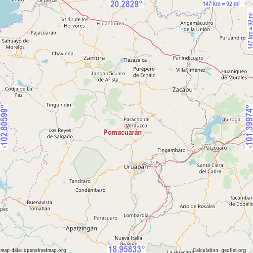
Pomacuarán GPS coordinates[2]
19° 37' 19.128" North, 102° 6' 10.296" West
| Map corner | latitude | longitude |
|---|---|---|
| Upper-left | 20.2829°, | -102.80599° |
| Center: | 19.62198°, | -102.10286° |
| Lower-right: | 18.95833°, | -101.39974° |
| Map W x H: | 147.3×147.3 km | = 91.5×91.5mi |
| max Lat: | 32.7° ⇑51.5% North |
| Pomacuarán: | 19.62198° |
| min Lat: | ⇓48.5% South 14.53588° |
| min Long | Pomacuarán | max Long |
| -117.105° | -102.10286° | -86.73105° |
| W 18.5%⇐ | ⇒81.5% E |
Elevation
Elevation of Pomacuarán is 2241 m = 7352 ft, and this is 987.3 m = 3239 ft above average elevation for this country.
| Max E: |
3497 m = 11473 ft | 16.1% |
| Pomacuarán | 2241 m 7352 ft | |
| Avg. | 1253.7 m = 4113 ft | |
Min E: |
-1 m = -3 ft | 83.9% |
See also: Mexico elevation on elevation.city.
Geographical zone
Pomacuarán is located in North Torrid zone (between Equator and Tropic of Cancer). Distance of this Northern Tropic circle is 424.2 km =263.6 mi to North.| Distance of | km | miles | from Pomacuarán |
|---|---|---|---|
| North Pole | 7825.3 | 4862.4 | to North |
| Arctic Circle | 5219.4 | 3243.2 | to North |
| Tropic Cancer | 424.2 | 263.6 | to North |
| Equator | 2181.8 | 1355.7 | to South |


Nearby cities:
15 places around Pomacuarán: (largest is in red/bold)
• Ahuirán
5.8 km =3.6 mi,  32°
32°
• Arantepacua
14.4 km =8.9 mi,  101°
101°
• Aranza
9.5 km =5.9 mi,  60°
60°
• Capácuaro
9.9 km =6.2 mi,  147°
147°
• Cherán Atzicuirín (Cheranástico)
12.6 km =7.8 mi,  46°
46°
• Cocucho
12.1 km =7.5 mi,  311°
311°
• Corupo
13.9 km =8.6 mi,  264°
264°
• Huécato
15 km =9.3 mi,  343°
343°
• Nurío
4.8 km =3 mi,  323°
323°
• Paracho de Verduzco
6.3 km =3.9 mi, 63°
• Quinceo
11.2 km =7 mi,  105°
105°
• San Felipe de los Herreros
8.2 km =5.1 mi,  266°
266°
• San Lorenzo
10.5 km =6.5 mi,  183°
183°
• Santa María Urapicho
6.7 km =4.2 mi,  351°
351°
• Tanaco
13.3 km =8.3 mi,  9°
9°
Sources, notices
• [Note1] Compared only with cities in Mexico existing in our database
• [Src1] Map data: © OpenStreetMap contributors (CC-BY-SA)
• [Src2] Other city data from geonames.org with taken over terms of usage.
• [Src3] Geographical zone / Annual Mean Temperature by Robert A. Rohde @ Wikipedia
