Corupo geodata
Corupo (Michoacán) is a populated place; located in Mexico in America/Mexico_City (GMT-6) time zone. With population of 1,994 people, there are 4365 cities with bigger population in this country. Compared to other cities in Mexico, 51.7% of cities are located further ↑North; 82.2% of cities are located further →East and 86.4% of cities have lower elevation than Corupo. Note1


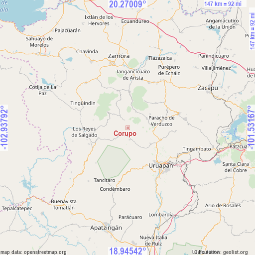
Corupo GPS coordinates[2]
19° 36' 32.832" North, 102° 14' 5.244" West
| Map corner | latitude | longitude |
|---|---|---|
| Upper-left | 20.27009°, | -102.93792° |
| Center: | 19.60912°, | -102.23479° |
| Lower-right: | 18.94542°, | -101.53167° |
| Map W x H: | 147.3×147.3 km | = 91.5×91.5mi |
| max Lat: | 32.7° ⇑51.7% North |
| Corupo: | 19.60912° |
| min Lat: | ⇓48.3% South 14.53588° |
| min Long | Corupo | max Long |
| -117.105° | -102.23479° | -86.73105° |
| W 17.8%⇐ | ⇒82.2% E |
Elevation
Elevation of Corupo is 2291 m = 7516 ft, and this is 1037.3 m = 3403 ft above average elevation for this country.
| Max E: |
3497 m = 11473 ft | 13.6% |
| Corupo | 2291 m 7516 ft | |
| Avg. | 1253.7 m = 4113 ft | |
Min E: |
-1 m = -3 ft | 86.4% |
See also: Mexico elevation on elevation.city.
Geographical zone
Corupo is located in North Torrid zone (between Equator and Tropic of Cancer). Distance of this Northern Tropic circle is 425.6 km =264.5 mi to North.| Distance of | km | miles | from Corupo |
|---|---|---|---|
| North Pole | 7826.7 | 4863.3 | to North |
| Arctic Circle | 5220.8 | 3244.1 | to North |
| Tropic Cancer | 425.6 | 264.5 | to North |
| Equator | 2180.3 | 1354.8 | to South |


Nearby cities:
15 places around Corupo: (largest is in red/bold)
• Angahuán
6.9 km =4.3 mi,  171°
171°
• Charapán
5 km =3.1 mi,  339°
339°
• Cherato
12.5 km =7.8 mi,  280°
280°
• Cocucho
10.7 km =6.6 mi,  26°
26°
• La Palma
10.7 km =6.6 mi,  266°
266°
• Nuevo Zirosto
13.6 km =8.5 mi,  240°
240°
• Nurío
12.2 km =7.6 mi,  64°
64°
• Pamatácuaro
14.8 km =9.2 mi,  308°
308°
• Pomacuarán
13.9 km =8.6 mi,  84°
84°
• San Benito
14.2 km =8.8 mi,  320°
320°
• San Felipe de los Herreros
5.7 km =3.5 mi, 81°
• Santa Ana Zirosto
12.5 km =7.8 mi,  228°
228°
• Santa María Urapicho
15.2 km =9.4 mi, 58°
• Zacán
7.3 km =4.5 mi, 229°
• Zicuicho
11.9 km =7.4 mi,  300°
300°
Sources, notices
• [Note1] Compared only with cities in Mexico existing in our database
• [Src1] Map data: © OpenStreetMap contributors (CC-BY-SA)
• [Src2] Other city data from geonames.org with taken over terms of usage.
• [Src3] Geographical zone / Annual Mean Temperature by Robert A. Rohde @ Wikipedia
