Palau geodata
Palau (Coahuila) is a populated place; located in Mexico in America/Monterrey (GMT-6) time zone. With population of 16,970 people, there are 564 cities with bigger population in this country. Compared to other cities in Mexico, 97.2% of cities are located further ↓South; 76.7% of cities are located further →East and 69.6% of cities have higher elevation than Palau. Note1


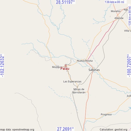
Palau GPS coordinates[2]
27° 53' 32.352" North, 101° 25' 23.484" West
| Map corner | latitude | longitude |
|---|---|---|
| Upper-left | 28.51197°, | -102.12632° |
| Center: | 27.89232°, | -101.42319° |
| Lower-right: | 27.2691°, | -100.72007° |
| Map W x H: | 138.2×138.2 km | = 85.9×85.9mi |
| max Lat: | 32.7° ⇑2.8% North |
| Palau: | 27.89232° |
| min Lat: | ⇓97.2% South 14.53588° |
| min Long | Palau | max Long |
| -117.105° | -101.42319° | -86.73105° |
| W 23.3%⇐ | ⇒76.7% E |
Elevation
Elevation of Palau is 433 m = 1421 ft, and this is 820.7 m = 2693 ft below average elevation for this country.
| Max E: |
3497 m = 11473 ft | 69.6% |
| Avg. | 1253.7 m = 4113 ft | |
| Palau | 433 m = 1421 ft | |
Min E: |
-1 m = -3 ft | 30.4% |
See also: Mexico elevation on elevation.city.
Geographical zone
Palau is located in North temperate zone (between Tropic of Cancer and the Arctic Circle). Distance of this Northern Tropic circle is 495.4 km =307.8 mi to South.| Distance of | km | miles | from Palau |
|---|---|---|---|
| North Pole | 6905.7 | 4291 | to North |
| Arctic Circle | 4299.8 | 2671.8 | to North |
| Tropic Cancer | 495.4 | 307.8 | to South |
| Equator | 3101.3 | 1927.1 | to South |


Nearby cities:
15 places around Palau: (largest is in red/bold)
• Ciudad Melchor Múzquiz
9.2 km =5.7 mi,  261°
261°
• Cloete
24.5 km =15.2 mi,  82°
82°
• Escobedo
73.2 km =45.5 mi,  179°
179°
• Los Álamos
69.7 km =43.3 mi,  42°
42°
• Minas de Barroterán
30.2 km =18.8 mi,  152°
152°
• Nueva Rosita
20.8 km =12.9 mi, 75°
• Progreso
67 km =41.6 mi,  140°
140°
• Rancherías
8.9 km =5.5 mi,  159°
159°
• Río Bravo
68.2 km =42.4 mi,  46°
46°
• Sabinas
30.3 km =18.8 mi,  97°
97°
• San José de Aura
34.2 km =21.3 mi,  171°
171°
• San Juan de Sabinas
12.3 km =7.6 mi,  70°
70°
• Santa María
10.2 km =6.3 mi,  358°
358°
• Valle Dorado
31 km =19.3 mi, 151°
• Villa Las Esperanzas
18 km =11.2 mi, 157°
Sources, notices
• [Note1] Compared only with cities in Mexico existing in our database
• [Src1] Map data: © OpenStreetMap contributors (CC-BY-SA)
• [Src2] Other city data from geonames.org with taken over terms of usage.
• [Src3] Geographical zone / Annual Mean Temperature by Robert A. Rohde @ Wikipedia
