Villa Las Esperanzas geodata
Villa Las Esperanzas (Coahuila) is a populated place; located in Mexico in America/Monterrey (GMT-6) time zone. With population of 3,029 people, there are 2969 cities with bigger population in this country. Compared to other cities in Mexico, 97.1% of cities are located further ↓South; 76.1% of cities are located further →East and 69.2% of cities have higher elevation than Villa Las Esperanzas. Note1
Current local time in Villa Las Esperanzas:
12:55 AM, WednesdayDifference from your time zone: hours


Villa Las Esperanzas GPS coordinates[2]
27° 44' 33.864" North, 101° 21' 10.62" West
| Map corner | latitude | longitude |
|---|---|---|
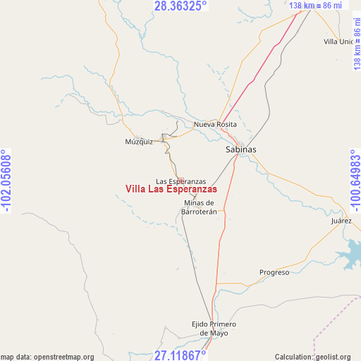
| Upper-left | 28.36325°, | -102.05608° |
| Center: | 27.74274°, | -101.35295° |
| Lower-right: | 27.11867°, | -100.64983° |
| Map W x H: | 138.4×138.4 km | = 86×86mi |
| max Lat: | 32.7° ⇑2.9% North |
| Villa Las Esperanzas: | 27.74274° |
| min Lat: | ⇓97.1% South 14.53588° |
| min Long | Villa Las Esper | max Long |
| -117.105° | -101.35295° | -86.73105° |
| W 23.9%⇐ | ⇒76.1% E |
Elevation
Elevation of Villa Las Esperanzas is 455 m = 1493 ft, and this is 798.7 m = 2620 ft below average elevation for this country.
| Max E: |
3497 m = 11473 ft | 69.2% |
| Avg. | 1253.7 m = 4113 ft | |
| Villa Las Esperanzas | 455 m = 1493 ft | |
Min E: |
-1 m = -3 ft | 30.8% |
See also: Mexico elevation on elevation.city.
Geographical zone
Villa Las Esperanzas is located in North temperate zone (between Tropic of Cancer and the Arctic Circle). Distance of this Northern Tropic circle is 478.8 km =297.5 mi to South.| Distance of | km | miles | from Villa Las Esperanzas |
|---|---|---|---|
| North Pole | 6922.4 | 4301.4 | to North |
| Arctic Circle | 4316.5 | 2682.1 | to North |
| Tropic Cancer | 478.8 | 297.5 | to South |
| Equator | 3084.7 | 1916.7 | to South |


Nearby cities:
15 places around Villa Las Esperanzas: (largest is in red/bold)
• Abasolo
62.8 km =39 mi,  186°
186°
• Ciudad Melchor Múzquiz
22.1 km =13.7 mi,  313°
313°
• Cloete
26.4 km =16.4 mi,  41°
41°
• Escobedo
56.9 km =35.4 mi, 185°
• Minas de Barroterán
12.3 km =7.6 mi,  145°
145°
• Nueva Rosita
25.7 km =16 mi,  31°
31°
• Palau
18 km =11.2 mi,  337°
337°
• Primero de Mayo
57.7 km =35.9 mi,  167°
167°
• Progreso
50.1 km =31.1 mi,  134°
134°
• Rancherías
9.1 km =5.7 mi, 335°
• Sabinas
26.4 km =16.4 mi,  61°
61°
• San José de Aura
17.3 km =10.7 mi, 186°
• San Juan de Sabinas
21.3 km =13.2 mi,  12°
12°
• Santa María
27.7 km =17.2 mi,  345°
345°
• Valle Dorado
13.3 km =8.3 mi,  143°
143°
Sources, notices
• [Note1] Compared only with cities in Mexico existing in our database
• [Src1] Map data: © OpenStreetMap contributors (CC-BY-SA)
• [Src2] Other city data from geonames.org with taken over terms of usage.
• [Src3] Geographical zone / Annual Mean Temperature by Robert A. Rohde @ Wikipedia
