Momax geodata
Momax (Zacatecas) is a seat of a second-order administrative division; located in Mexico in America/Mexico_City (GMT-6) time zone. With population of 1,626 people, there are 5322 cities with bigger population in this country. Compared to other cities in Mexico, 83.7% of cities are located further ↓South; 87.2% of cities are located further →East and 56.8% of cities have lower elevation than Momax. Note1


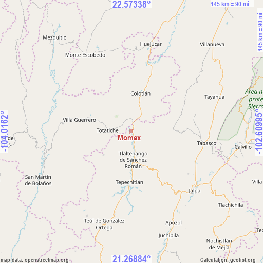
Momax GPS coordinates[2]
21° 55' 21.36" North, 103° 18' 47.052" West
| Map corner | latitude | longitude |
|---|---|---|
| Upper-left | 22.57338°, | -104.0162° |
| Center: | 21.9226°, | -103.31307° |
| Lower-right: | 21.26884°, | -102.60995° |
| Map W x H: | 145.1×145.1 km | = 90.2×90.2mi |
| max Lat: | 32.7° ⇑16.3% North |
| Momax: | 21.9226° |
| min Lat: | ⇓83.7% South 14.53588° |
| min Long | Momax | max Long |
| -117.105° | -103.31307° | -86.73105° |
| W 12.8%⇐ | ⇒87.2% E |
Elevation
Elevation of Momax is 1650 m = 5413 ft, and this is 396.3 m = 1300 ft above average elevation for this country.
| Max E: |
3497 m = 11473 ft | 43.2% |
| Momax | 1650 m 5413 ft | |
| Avg. | 1253.7 m = 4113 ft | |
Min E: |
-1 m = -3 ft | 56.8% |
See also: Mexico elevation on elevation.city.
Geographical zone
Momax is located in North Torrid zone (between Equator and Tropic of Cancer). Distance of this Northern Tropic circle is 168.4 km =104.6 mi to North.| Distance of | km | miles | from Momax |
|---|---|---|---|
| North Pole | 7569.5 | 4703.5 | to North |
| Arctic Circle | 4963.6 | 3084.2 | to North |
| Tropic Cancer | 168.4 | 104.6 | to North |
| Equator | 2437.6 | 1514.7 | to South |


Nearby cities:
15 places around Momax: (largest is in red/bold)
• Atolinga
20.3 km =12.6 mi,  230°
230°
• Cicacalco
23 km =14.3 mi,  179°
179°
• Colotlán
21.7 km =13.5 mi,  12°
12°
• El Plateado de Joaquín Amaro
22.8 km =14.2 mi,  86°
86°
• Fraccionamiento Santo Santiago
16.2 km =10.1 mi,  164°
164°
• Huiscolco
38.1 km =23.7 mi, 94°
• Las Golondrinas [Fraccionamiento]
21.2 km =13.2 mi,  16°
16°
• Santa María de los Ángeles
29.4 km =18.3 mi, 18°
• Saúz de los Márquez
29.2 km =18.1 mi,  43°
43°
• Talesteipa
24.5 km =15.2 mi, 179°
• Temastián (La Cantera)
22.7 km =14.1 mi,  285°
285°
• Tepechitlán
28.1 km =17.5 mi, 182°
• Tlaltenango de Sánchez Román
15.6 km =9.7 mi, 176°
• Totatiche
13.5 km =8.4 mi,  272°
272°
• Villa Guerrero
29.9 km =18.6 mi,  283°
283°
Sources, notices
• [Note1] Compared only with cities in Mexico existing in our database
• [Src1] Map data: © OpenStreetMap contributors (CC-BY-SA)
• [Src2] Other city data from geonames.org with taken over terms of usage.
• [Src3] Geographical zone / Annual Mean Temperature by Robert A. Rohde @ Wikipedia
