Atolinga geodata
Atolinga (Zacatecas) is a seat of a second-order administrative division; located in Mexico in America/Mexico_City (GMT-6) time zone. With population of 1,601 people, there are 5401 cities with bigger population in this country. Compared to other cities in Mexico, 83% of cities are located further ↓South; 88.2% of cities are located further →East and 79.8% of cities have lower elevation than Atolinga. Note1


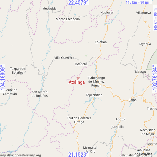
Atolinga GPS coordinates[2]
21° 48' 23.724" North, 103° 27' 53.856" West
| Map corner | latitude | longitude |
|---|---|---|
| Upper-left | 22.4579°, | -104.16809° |
| Center: | 21.80659°, | -103.46496° |
| Lower-right: | 21.1523°, | -102.76184° |
| Map W x H: | 145.2×145.2 km | = 90.2×90.2mi |
| max Lat: | 32.7° ⇑17% North |
| Atolinga: | 21.80659° |
| min Lat: | ⇓83% South 14.53588° |
| min Long | Atolinga | max Long |
| -117.105° | -103.46496° | -86.73105° |
| W 11.8%⇐ | ⇒88.2% E |
Elevation
Elevation of Atolinga is 2136 m = 7008 ft, and this is 882.3 m = 2895 ft above average elevation for this country.
| Max E: |
3497 m = 11473 ft | 20.2% |
| Atolinga | 2136 m 7008 ft | |
| Avg. | 1253.7 m = 4113 ft | |
Min E: |
-1 m = -3 ft | 79.8% |
See also: Mexico elevation on elevation.city.
Geographical zone
Atolinga is located in North Torrid zone (between Equator and Tropic of Cancer). Distance of this Northern Tropic circle is 181.3 km =112.7 mi to North.| Distance of | km | miles | from Atolinga |
|---|---|---|---|
| North Pole | 7582.4 | 4711.5 | to North |
| Arctic Circle | 4976.5 | 3092.3 | to North |
| Tropic Cancer | 181.3 | 112.7 | to North |
| Equator | 2424.7 | 1506.6 | to South |


Nearby cities:
15 places around Atolinga: (largest is in red/bold)
• Bolaños
32.7 km =20.3 mi,  274°
274°
• Chimaltitán
32.7 km =20.3 mi,  264°
264°
• Cicacalco
18.7 km =11.6 mi,  122°
122°
• El Tepec
32.1 km =19.9 mi,  276°
276°
• Fraccionamiento Santo Santiago
20.3 km =12.6 mi,  97°
97°
• Momax
20.3 km =12.6 mi,  50°
50°
• San Pedro Ocotlán
34 km =21.1 mi,  151°
151°
• Santa María de la Paz
33.3 km =20.7 mi,  169°
169°
• Talesteipa
19.6 km =12.2 mi,  126°
126°
• Temastián (La Cantera)
20 km =12.4 mi,  341°
341°
• Tepechitlán
20.8 km =12.9 mi,  136°
136°
• Tepizuac
27.1 km =16.8 mi,  221°
221°
• Tlaltenango de Sánchez Román
16.9 km =10.5 mi, 99°
• Totatiche
13.7 km =8.5 mi,  9°
9°
• Villa Guerrero
23.8 km =14.8 mi,  325°
325°
Sources, notices
• [Note1] Compared only with cities in Mexico existing in our database
• [Src1] Map data: © OpenStreetMap contributors (CC-BY-SA)
• [Src2] Other city data from geonames.org with taken over terms of usage.
• [Src3] Geographical zone / Annual Mean Temperature by Robert A. Rohde @ Wikipedia
