Los Reyes geodata
Los Reyes (Michoacán) is a populated place; located in Mexico in America/Mexico_City (GMT-6) time zone. With population of 520 people, there are 16208 cities with bigger population in this country. Compared to other cities in Mexico, 51.7% of cities are located further ↓South; 66.9% of cities are located further →East and 92% of cities have lower elevation than Los Reyes. Note1


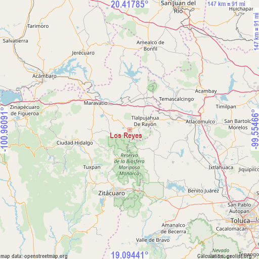
Los Reyes GPS coordinates[2]
19° 45' 27" North, 100° 15' 28.008" West
| Map corner | latitude | longitude |
|---|---|---|
| Upper-left | 20.41785°, | -100.96091° |
| Center: | 19.7575°, | -100.25778° |
| Lower-right: | 19.09441°, | -99.55466° |
| Map W x H: | 147.2×147.2 km | = 91.5×91.5mi |
| max Lat: | 32.7° ⇑48.3% North |
| Los Reyes: | 19.7575° |
| min Lat: | ⇓51.7% South 14.53588° |
| min Long | Los Reyes | max Long |
| -117.105° | -100.25778° | -86.73105° |
| W 33.1%⇐ | ⇒66.9% E |
Elevation
Elevation of Los Reyes is 2486 m = 8156 ft, and this is 1232.3 m = 4043 ft above average elevation for this country.
| Max E: |
3497 m = 11473 ft | 8% |
| Los Reyes | 2486 m 8156 ft | |
| Avg. | 1253.7 m = 4113 ft | |
Min E: |
-1 m = -3 ft | 92% |
See also: Mexico elevation on elevation.city.
Geographical zone
Los Reyes is located in North Torrid zone (between Equator and Tropic of Cancer). Distance of this Northern Tropic circle is 409.1 km =254.2 mi to North.| Distance of | km | miles | from Los Reyes |
|---|---|---|---|
| North Pole | 7810.2 | 4853 | to North |
| Arctic Circle | 5204.3 | 3233.8 | to North |
| Tropic Cancer | 409.1 | 254.2 | to North |
| Equator | 2196.8 | 1365 | to South |


Nearby cities:
15 places around Los Reyes: (largest is in red/bold)
• Chincua (Colonia Emiliano Zapata)
3.4 km =2.1 mi,  274°
274°
• El Huérfano (Emiliano Zapata)
5.2 km =3.2 mi,  291°
291°
• Estanzuela (La Hacienda)
8.1 km =5 mi,  77°
77°
• Guadalupe Victoria
2.3 km =1.4 mi,  352°
352°
• Los Remedios
8.1 km =5 mi,  53°
53°
• Milpillas
7.6 km =4.7 mi,  302°
302°
• Monte Alegre
7 km =4.3 mi,  44°
44°
• San Isidro
5.8 km =3.6 mi, 78°
• San José Corrales
3.7 km =2.3 mi,  178°
178°
• San Pedro Tarímbaro
6.6 km =4.1 mi,  31°
31°
• San Rafael
4.7 km =2.9 mi,  130°
130°
• Sandía
8.3 km =5.2 mi, 39°
• Santa María de los Ángeles
6.9 km =4.3 mi,  62°
62°
• Segunda Manzana de Chincua
4.9 km =3 mi, 303°
• Tupátaro
8 km =5 mi,  321°
321°
Sources, notices
• [Note1] Compared only with cities in Mexico existing in our database
• [Src1] Map data: © OpenStreetMap contributors (CC-BY-SA)
• [Src2] Other city data from geonames.org with taken over terms of usage.
• [Src3] Geographical zone / Annual Mean Temperature by Robert A. Rohde @ Wikipedia
