San Pedro Tarímbaro geodata
San Pedro Tarímbaro (State of Mexico) is a populated place; located in Mexico in America/Mexico_City (GMT-6) time zone. With population of 1,353 people, there are 6427 cities with bigger population in this country. Compared to other cities in Mexico, 53% of cities are located further ↓South; 66.7% of cities are located further →East and 95.2% of cities have lower elevation than San Pedro Tarímbaro. Note1


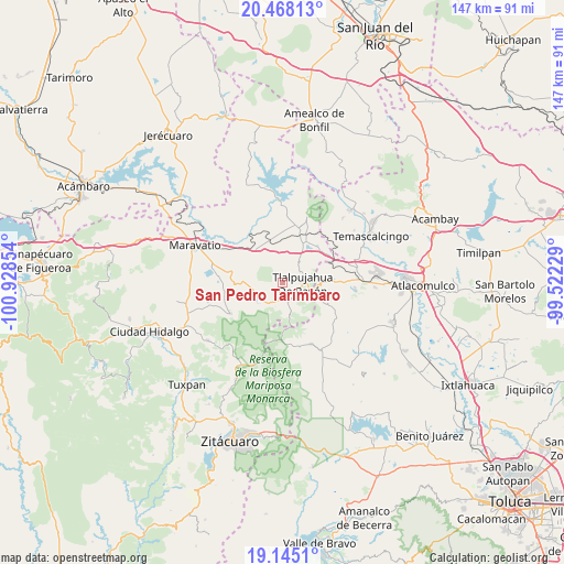
San Pedro Tarímbaro GPS coordinates[2]
19° 48' 28.764" North, 100° 13' 31.476" West
| Map corner | latitude | longitude |
|---|---|---|
| Upper-left | 20.46813°, | -100.92854° |
| Center: | 19.80799°, | -100.22541° |
| Lower-right: | 19.1451°, | -99.52229° |
| Map W x H: | 147.1×147.1 km | = 91.4×91.4mi |
| max Lat: | 32.7° ⇑47% North |
| San Pedro Tarímbaro: | 19.80799° |
| min Lat: | ⇓53% South 14.53588° |
| min Long | San Pedro Tarí | max Long |
| -117.105° | -100.22541° | -86.73105° |
| W 33.3%⇐ | ⇒66.7% E |
Elevation
Elevation of San Pedro Tarímbaro is 2599 m = 8527 ft, and this is 1345.3 m = 4414 ft above average elevation for this country.
| Max E: |
3497 m = 11473 ft | 4.8% |
| San Pedro Tarímbaro | 2599 m 8527 ft | |
| Avg. | 1253.7 m = 4113 ft | |
Min E: |
-1 m = -3 ft | 95.2% |
See also: Mexico elevation on elevation.city.
Geographical zone
San Pedro Tarímbaro is located in North Torrid zone (between Equator and Tropic of Cancer). Distance of this Northern Tropic circle is 403.5 km =250.7 mi to North.| Distance of | km | miles | from San Pedro Tarímbaro |
|---|---|---|---|
| North Pole | 7804.6 | 4849.6 | to North |
| Arctic Circle | 5198.7 | 3230.3 | to North |
| Tropic Cancer | 403.5 | 250.7 | to North |
| Equator | 2202.4 | 1368.5 | to South |


Nearby cities:
15 places around San Pedro Tarímbaro: (largest is in red/bold)
• El Gigante
5.7 km =3.5 mi,  34°
34°
• Estanzuela (La Hacienda)
5.9 km =3.7 mi,  130°
130°
• Guadalupe Victoria
5 km =3.1 mi,  227°
227°
• Los Remedios
3.3 km =2.1 mi,  104°
104°
• Los Reyes
6.6 km =4.1 mi,  211°
211°
• Monte Alegre
1.7 km =1.1 mi,  112°
112°
• San Isidro
5 km =3.1 mi,  152°
152°
• San Juan Tlalpujahuilla (Tlalpujahuilla)
6.7 km =4.2 mi, 107°
• San Miguel el Alto (El Puerto)
5.5 km =3.4 mi,  320°
320°
• Sandía
2.1 km =1.3 mi,  67°
67°
• Santa María de los Ángeles
3.6 km =2.2 mi, 131°
• Segunda Manzana de Chincua
8 km =5 mi,  248°
248°
• Tlalpujahua de Rayón
5.4 km =3.4 mi,  93°
93°
• Tupátaro
8.4 km =5.2 mi,  274°
274°
• Venta de Bravo
8.3 km =5.2 mi,  41°
41°
Sources, notices
• [Note1] Compared only with cities in Mexico existing in our database
• [Src1] Map data: © OpenStreetMap contributors (CC-BY-SA)
• [Src2] Other city data from geonames.org with taken over terms of usage.
• [Src3] Geographical zone / Annual Mean Temperature by Robert A. Rohde @ Wikipedia
