Los Haros geodata
Los Haros (Zacatecas) is a populated place; located in Mexico in America/Mexico_City (GMT-6) time zone. With population of 800 people, there are 10908 cities with bigger population in this country. Compared to other cities in Mexico, 87.5% of cities are located further ↓South; 85.6% of cities are located further →East and 77.1% of cities have lower elevation than Los Haros. Note1


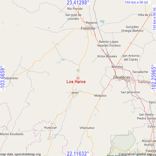
Los Haros GPS coordinates[2]
22° 45' 58.284" North, 102° 57' 45.972" West
| Map corner | latitude | longitude |
|---|---|---|
| Upper-left | 23.41298°, | -103.6659° |
| Center: | 22.76619°, | -102.96277° |
| Lower-right: | 22.11632°, | -102.25965° |
| Map W x H: | 144.2×144.2 km | = 89.6×89.6mi |
| max Lat: | 32.7° ⇑12.5% North |
| Los Haros: | 22.76619° |
| min Lat: | ⇓87.5% South 14.53588° |
| min Long | Los Haros | max Long |
| -117.105° | -102.96277° | -86.73105° |
| W 14.4%⇐ | ⇒85.6% E |
Elevation
Elevation of Los Haros is 2070 m = 6791 ft, and this is 816.3 m = 2678 ft above average elevation for this country.
| Max E: |
3497 m = 11473 ft | 22.9% |
| Los Haros | 2070 m 6791 ft | |
| Avg. | 1253.7 m = 4113 ft | |
Min E: |
-1 m = -3 ft | 77.1% |
See also: Mexico elevation on elevation.city.
Geographical zone
Los Haros is located in North Torrid zone (between Equator and Tropic of Cancer). Distance of this Northern Tropic circle is 74.6 km =46.4 mi to North.| Distance of | km | miles | from Los Haros |
|---|---|---|---|
| North Pole | 7475.7 | 4645.2 | to North |
| Arctic Circle | 4869.8 | 3026 | to North |
| Tropic Cancer | 74.6 | 46.4 | to North |
| Equator | 2531.4 | 1572.9 | to South |


Nearby cities:
15 places around Los Haros: (largest is in red/bold)
• Adjuntas del Peñasco (El Peñasco)
28 km =17.4 mi,  26°
26°
• Benito Juárez
24 km =14.9 mi,  108°
108°
• Cieneguillas
30.8 km =19.1 mi,  91°
91°
• Colonia Felipe Ángeles
29.8 km =18.5 mi,  144°
144°
• El Fuerte
26 km =16.2 mi,  119°
119°
• Ermita de Guadalupe
21.3 km =13.2 mi,  199°
199°
• Ermita de los Correas
16.5 km =10.3 mi,  340°
340°
• Francisco I. Madero
25.4 km =15.8 mi,  82°
82°
• González Ortega (Machines)
27.3 km =17 mi, 113°
• Jerez de García Salinas
13.3 km =8.3 mi,  192°
192°
• Malpaso
25.8 km =16 mi,  127°
127°
• Río Frío
24 km =14.9 mi,  42°
42°
• Santa Rita (Luis Moya)
4.5 km =2.8 mi,  152°
152°
• Santa Rosa
23.6 km =14.7 mi,  319°
319°
• Susticacán
22.2 km =13.8 mi,  218°
218°
Sources, notices
• [Note1] Compared only with cities in Mexico existing in our database
• [Src1] Map data: © OpenStreetMap contributors (CC-BY-SA)
• [Src2] Other city data from geonames.org with taken over terms of usage.
• [Src3] Geographical zone / Annual Mean Temperature by Robert A. Rohde @ Wikipedia
