González Ortega (Machines) geodata
González Ortega (Machines) (Zacatecas) is a populated place; located in Mexico in America/Mexico_City (GMT-6) time zone. With population of 871 people, there are 10028 cities with bigger population in this country. Compared to other cities in Mexico, 87.3% of cities are located further ↓South; 84.9% of cities are located further →East and 81.6% of cities have lower elevation than González Ortega (Machines). Note1
Current local time in González Ortega (Machines):
05:16 AM, WednesdayDifference from your time zone: hours


González Ortega (Machines) GPS coordinates[2]
22° 40' 5.988" North, 102° 43' 8.004" West
| Map corner | latitude | longitude |
|---|---|---|
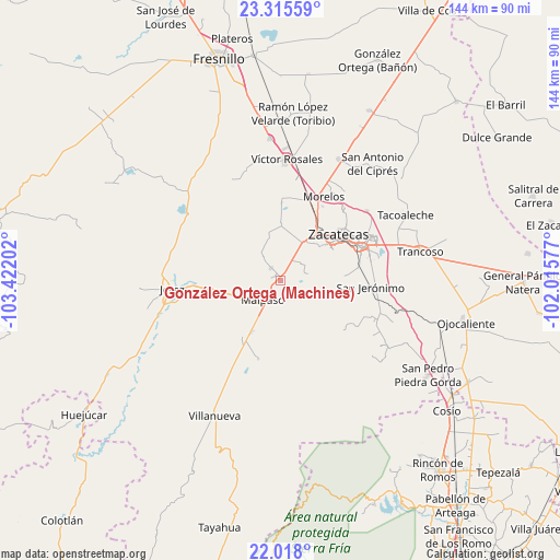
| Upper-left | 23.31559°, | -103.42202° |
| Center: | 22.66833°, | -102.71889° |
| Lower-right: | 22.018°, | -102.01577° |
| Map W x H: | 144.3×144.3 km | = 89.7×89.7mi |
| max Lat: | 32.7° ⇑12.7% North |
| González Ortega (Machines): | 22.66833° |
| min Lat: | ⇓87.3% South 14.53588° |
| min Long | González Orteg | max Long |
| -117.105° | -102.71889° | -86.73105° |
| W 15.1%⇐ | ⇒84.9% E |
Elevation
Elevation of González Ortega (Machines) is 2180 m = 7152 ft, and this is 926.3 m = 3039 ft above average elevation for this country.
| Max E: |
3497 m = 11473 ft | 18.4% |
| González Ortega (Machines) | 2180 m 7152 ft | |
| Avg. | 1253.7 m = 4113 ft | |
Min E: |
-1 m = -3 ft | 81.6% |
See also: Mexico elevation on elevation.city.
Geographical zone
González Ortega (Machines) is located in North Torrid zone (between Equator and Tropic of Cancer). Distance of this Northern Tropic circle is 85.4 km =53.1 mi to North.| Distance of | km | miles | from González Ortega (Machines) |
|---|---|---|---|
| North Pole | 7486.6 | 4652 | to North |
| Arctic Circle | 4880.7 | 3032.7 | to North |
| Tropic Cancer | 85.4 | 53.1 | to North |
| Equator | 2520.5 | 1566.2 | to South |


Nearby cities:
15 places around González Ortega (Machines): (largest is in red/bold)
• Bañuelos
21 km =13 mi,  95°
95°
• Benito Juárez
4 km =2.5 mi,  324°
324°
• Cieneguillas
11.4 km =7.1 mi,  30°
30°
• Colonia Felipe Ángeles
15.3 km =9.5 mi,  209°
209°
• El Fuerte
3 km =1.9 mi,  230°
230°
• Francisco I. Madero
14.3 km =8.9 mi,  0°
0°
• García de la Cadena
7.1 km =4.4 mi,  52°
52°
• Hacienda Nueva
20.7 km =12.9 mi, 33°
• Las Pilas
22 km =13.7 mi, 29°
• Malpaso
6.4 km =4 mi,  223°
223°
• Perales
22 km =13.7 mi,  129°
129°
• Picones
12.9 km =8 mi,  42°
42°
• Pimienta
16.3 km =10.1 mi, 33°
• San Ramón
20.2 km =12.6 mi,  80°
80°
• Zacatecas
18 km =11.2 mi, 51°
Sources, notices
• [Note1] Compared only with cities in Mexico existing in our database
• [Src1] Map data: © OpenStreetMap contributors (CC-BY-SA)
• [Src2] Other city data from geonames.org with taken over terms of usage.
• [Src3] Geographical zone / Annual Mean Temperature by Robert A. Rohde @ Wikipedia
