General Francisco Villa geodata
General Francisco Villa (Michoacán) is a populated place; located in Mexico in America/Mexico_City (GMT-6) time zone. With population of 1,298 people, there are 6677 cities with bigger population in this country. Compared to other cities in Mexico, 69.6% of cities are located further ↑North; 82.4% of cities are located further →East and 73.2% of cities have higher elevation than General Francisco Villa. Note1
Current local time in General Francisco Villa:
05:27 AM, WednesdayDifference from your time zone: hours


General Francisco Villa GPS coordinates[2]
18° 44' 34.944" North, 102° 14' 57.12" West
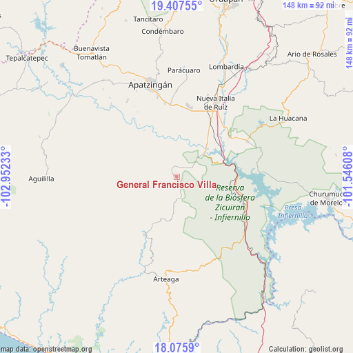
| Map corner | latitude | longitude |
|---|---|---|
| Upper-left | 19.40755°, | -102.95233° |
| Center: | 18.74304°, | -102.2492° |
| Lower-right: | 18.0759°, | -101.54608° |
| Map W x H: | 148.1×148.1 km | = 92×92mi |
| max Lat: | 32.7° ⇑69.6% North |
| General Francisco Villa: | 18.74304° |
| min Lat: | ⇓30.4% South 14.53588° |
| min Long | General Francis | max Long |
| -117.105° | -102.2492° | -86.73105° |
| W 17.6%⇐ | ⇒82.4% E |
Elevation
Elevation of General Francisco Villa is 280 m = 919 ft, and this is 973.7 m = 3195 ft below average elevation for this country.
| Max E: |
3497 m = 11473 ft | 73.2% |
| Avg. | 1253.7 m = 4113 ft | |
| General Francisco Villa | 280 m = 919 ft | |
Min E: |
-1 m = -3 ft | 26.8% |
See also: Mexico elevation on elevation.city.
Geographical zone
General Francisco Villa is located in North Torrid zone (between Equator and Tropic of Cancer). Distance of this Northern Tropic circle is 521.9 km =324.3 mi to North.| Distance of | km | miles | from General Francisco Villa |
|---|---|---|---|
| North Pole | 7923 | 4923.1 | to North |
| Arctic Circle | 5317.1 | 3303.9 | to North |
| Tropic Cancer | 521.9 | 324.3 | to North |
| Equator | 2084 | 1294.9 | to South |


Nearby cities:
15 places around General Francisco Villa: (largest is in red/bold)
• Bellas Fuentes (Nuevo Centro)
25.6 km =15.9 mi,  89°
89°
• Cancita
23 km =14.3 mi,  347°
347°
• Cupuán del Río
7.5 km =4.7 mi,  58°
58°
• El Ceñidor
29.5 km =18.3 mi,  12°
12°
• El Chauz
27.6 km =17.1 mi,  53°
53°
• El Letrero
28.5 km =17.7 mi,  30°
30°
• Gambara
25.5 km =15.8 mi, 34°
• La Mira Tumbiscatio
7.5 km =4.7 mi,  208°
208°
• Las Crucitas
17.5 km =10.9 mi, 5°
• Las Yeguas
18.4 km =11.4 mi, 350°
• Los Ciriancitos
26.7 km =16.6 mi,  103°
103°
• Los Pozos
18.8 km =11.7 mi,  15°
15°
• Nuevo Capirio
19.2 km =11.9 mi, 45°
• Tumbiscatío de Ruiz
27.6 km =17.1 mi, 209°
• Uspero
30.2 km =18.8 mi,  356°
356°
Sources, notices
• [Note1] Compared only with cities in Mexico existing in our database
• [Src1] Map data: © OpenStreetMap contributors (CC-BY-SA)
• [Src2] Other city data from geonames.org with taken over terms of usage.
• [Src3] Geographical zone / Annual Mean Temperature by Robert A. Rohde @ Wikipedia
