Bellas Fuentes (Nuevo Centro) geodata
Bellas Fuentes (Nuevo Centro) (Michoacán) is a populated place; located in Mexico in America/Mexico_City (GMT-6) time zone. With population of 692 people, there are 12576 cities with bigger population in this country. Compared to other cities in Mexico, 69.6% of cities are located further ↑North; 81% of cities are located further →East and 76% of cities have higher elevation than Bellas Fuentes (Nuevo Centro). Note1
Current local time in Bellas Fuentes (Nuevo Centro):
06:51 AM, WednesdayDifference from your time zone: hours


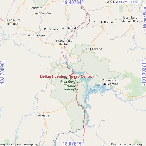
Bellas Fuentes (Nuevo Centro) GPS coordinates[2]
18° 44' 35.988" North, 102° 0' 20.988" West
| Map corner | latitude | longitude |
|---|---|---|
| Upper-left | 19.40784°, | -102.70896° |
| Center: | 18.74333°, | -102.00583° |
| Lower-right: | 18.07619°, | -101.30271° |
| Map W x H: | 148.1×148.1 km | = 92×92mi |
| max Lat: | 32.7° ⇑69.6% North |
| Bellas Fuentes (Nuevo Centro): | 18.74333° |
| min Lat: | ⇓30.4% South 14.53588° |
| min Long | Bellas Fuentes | max Long |
| -117.105° | -102.00583° | -86.73105° |
| W 19%⇐ | ⇒81% E |
Elevation
Elevation of Bellas Fuentes (Nuevo Centro) is 186 m = 610 ft, and this is 1067.7 m = 3503 ft below average elevation for this country.
| Max E: |
3497 m = 11473 ft | 76% |
| Avg. | 1253.7 m = 4113 ft | |
| Bellas Fuentes (Nuevo Centro) | 186 m = 610 ft | |
Min E: |
-1 m = -3 ft | 24% |
See also: Mexico elevation on elevation.city.
Geographical zone
Bellas Fuentes (Nuevo Centro) is located in North Torrid zone (between Equator and Tropic of Cancer). Distance of this Northern Tropic circle is 521.9 km =324.3 mi to North.| Distance of | km | miles | from Bellas Fuentes (Nuevo Centro) |
|---|---|---|---|
| North Pole | 7923 | 4923.1 | to North |
| Arctic Circle | 5317.1 | 3303.9 | to North |
| Tropic Cancer | 521.9 | 324.3 | to North |
| Equator | 2084.1 | 1295 | to South |


Nearby cities:
15 places around Bellas Fuentes (Nuevo Centro): (largest is in red/bold)
• Cuatro Caminos
29.1 km =18.1 mi,  339°
339°
• Cupuán del Río
19.5 km =12.1 mi,  281°
281°
• El Chauz
16.9 km =10.5 mi,  347°
347°
• El Letrero
26.8 km =16.7 mi, 335°
• Gambara
23.8 km =14.8 mi,  331°
331°
• General Francisco Villa
25.6 km =15.9 mi,  269°
269°
• Ichamio
30.1 km =18.7 mi,  39°
39°
• La Mira Tumbiscatio
30 km =18.6 mi,  257°
257°
• Las Cañas
20 km =12.4 mi,  170°
170°
• Las Crucitas
29.7 km =18.5 mi,  305°
305°
• Los Ciriancitos
6.2 km =3.9 mi,  177°
177°
• Los Pozos
27.3 km =17 mi, 311°
• Nuevo Capirio
18 km =11.2 mi,  318°
318°
• Palma de Huaro
27.2 km =16.9 mi,  94°
94°
• Zicuirán
15.5 km =9.6 mi,  14°
14°
Sources, notices
• [Note1] Compared only with cities in Mexico existing in our database
• [Src1] Map data: © OpenStreetMap contributors (CC-BY-SA)
• [Src2] Other city data from geonames.org with taken over terms of usage.
• [Src3] Geographical zone / Annual Mean Temperature by Robert A. Rohde @ Wikipedia
