Cupuán del Río geodata
Cupuán del Río (Michoacán) is a populated place; located in Mexico in America/Mexico_City (GMT-6) time zone. With population of 1,167 people, there are 7434 cities with bigger population in this country. Compared to other cities in Mexico, 69.1% of cities are located further ↑North; 81.9% of cities are located further →East and 74.7% of cities have higher elevation than Cupuán del Río. Note1


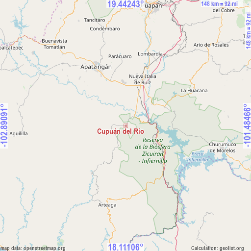
Cupuán del Río GPS coordinates[2]
18° 46' 41.016" North, 102° 11' 16.008" West
| Map corner | latitude | longitude |
|---|---|---|
| Upper-left | 19.44243°, | -102.89091° |
| Center: | 18.77806°, | -102.18778° |
| Lower-right: | 18.11106°, | -101.48466° |
| Map W x H: | 148×148 km | = 92×92mi |
| max Lat: | 32.7° ⇑69.1% North |
| Cupuán del Río: | 18.77806° |
| min Lat: | ⇓30.9% South 14.53588° |
| min Long | Cupuán del Rí | max Long |
| -117.105° | -102.18778° | -86.73105° |
| W 18.1%⇐ | ⇒81.9% E |
Elevation
Elevation of Cupuán del Río is 230 m = 755 ft, and this is 1023.7 m = 3359 ft below average elevation for this country.
| Max E: |
3497 m = 11473 ft | 74.7% |
| Avg. | 1253.7 m = 4113 ft | |
| Cupuán del Río | 230 m = 755 ft | |
Min E: |
-1 m = -3 ft | 25.3% |
See also: Mexico elevation on elevation.city.
Geographical zone
Cupuán del Río is located in North Torrid zone (between Equator and Tropic of Cancer). Distance of this Northern Tropic circle is 518 km =321.9 mi to North.| Distance of | km | miles | from Cupuán del Río |
|---|---|---|---|
| North Pole | 7919.1 | 4920.7 | to North |
| Arctic Circle | 5313.2 | 3301.5 | to North |
| Tropic Cancer | 518 | 321.9 | to North |
| Equator | 2087.9 | 1297.4 | to South |


Nearby cities:
15 places around Cupuán del Río: (largest is in red/bold)
• Bellas Fuentes (Nuevo Centro)
19.5 km =12.1 mi,  101°
101°
• Cancita
21.8 km =13.5 mi,  328°
328°
• Cuatro Caminos
25 km =15.5 mi,  20°
20°
• El Ceñidor
25 km =15.5 mi,  359°
359°
• El Chauz
20.1 km =12.5 mi,  50°
50°
• El Letrero
22.2 km =13.8 mi, 21°
• Gambara
18.9 km =11.7 mi, 24°
• General Francisco Villa
7.5 km =4.7 mi,  238°
238°
• La Mira Tumbiscatio
14.6 km =9.1 mi,  223°
223°
• Las Crucitas
14.4 km =8.9 mi,  340°
340°
• Las Yeguas
17.1 km =10.6 mi, 326°
• Los Ciriancitos
21.9 km =13.6 mi,  117°
117°
• Los Pozos
14.2 km =8.8 mi,  354°
354°
• Nuevo Capirio
12 km =7.5 mi,  36°
36°
• Zicuirán
25.6 km =15.9 mi,  64°
64°
Sources, notices
• [Note1] Compared only with cities in Mexico existing in our database
• [Src1] Map data: © OpenStreetMap contributors (CC-BY-SA)
• [Src2] Other city data from geonames.org with taken over terms of usage.
• [Src3] Geographical zone / Annual Mean Temperature by Robert A. Rohde @ Wikipedia
