Las Yeguas geodata
Las Yeguas (Michoacán) is a populated place; located in Mexico in America/Mexico_City (GMT-6) time zone. With population of 727 people, there are 12009 cities with bigger population in this country. Compared to other cities in Mexico, 66.8% of cities are located further ↑North; 82.6% of cities are located further →East and 75.4% of cities have higher elevation than Las Yeguas. Note1


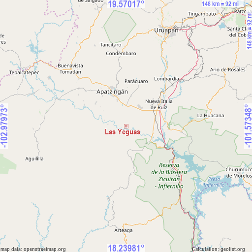
Las Yeguas GPS coordinates[2]
18° 54' 22.716" North, 102° 16' 35.76" West
| Map corner | latitude | longitude |
|---|---|---|
| Upper-left | 19.57017°, | -102.97973° |
| Center: | 18.90631°, | -102.2766° |
| Lower-right: | 18.23981°, | -101.57348° |
| Map W x H: | 147.9×147.9 km | = 91.9×91.9mi |
| max Lat: | 32.7° ⇑66.8% North |
| Las Yeguas: | 18.90631° |
| min Lat: | ⇓33.2% South 14.53588° |
| min Long | Las Yeguas | max Long |
| -117.105° | -102.2766° | -86.73105° |
| W 17.4%⇐ | ⇒82.6% E |
Elevation
Elevation of Las Yeguas is 207 m = 679 ft, and this is 1046.7 m = 3434 ft below average elevation for this country.
| Max E: |
3497 m = 11473 ft | 75.4% |
| Avg. | 1253.7 m = 4113 ft | |
| Las Yeguas | 207 m = 679 ft | |
Min E: |
-1 m = -3 ft | 24.6% |
See also: Mexico elevation on elevation.city.
Geographical zone
Las Yeguas is located in North Torrid zone (between Equator and Tropic of Cancer). Distance of this Northern Tropic circle is 503.7 km =313 mi to North.| Distance of | km | miles | from Las Yeguas |
|---|---|---|---|
| North Pole | 7904.9 | 4911.9 | to North |
| Arctic Circle | 5299 | 3292.6 | to North |
| Tropic Cancer | 503.7 | 313 | to North |
| Equator | 2102.2 | 1306.2 | to South |


Nearby cities:
15 places around Las Yeguas: (largest is in red/bold)
• Antúnez
14.2 km =8.8 mi,  32°
32°
• Antúnez (Morelos)
14.1 km =8.8 mi, 32°
• Cancita
4.8 km =3 mi,  335°
335°
• Chiquihuitillo
13.5 km =8.4 mi,  327°
327°
• Cupuán del Río
17.1 km =10.6 mi,  146°
146°
• El Ceñidor
14 km =8.7 mi,  40°
40°
• Fraccionamiento Girasoles
16.7 km =10.4 mi,  345°
345°
• Gambara
17.5 km =10.9 mi,  80°
80°
• General Francisco Villa
18.4 km =11.4 mi,  170°
170°
• Las Crucitas
4.5 km =2.8 mi,  99°
99°
• Los Pozos
8 km =5 mi,  90°
90°
• Nuevo Capirio
17.2 km =10.7 mi,  105°
105°
• San Antonio la Labor
13.9 km =8.6 mi, 349°
• Uspero
12 km =7.5 mi,  3°
3°
• Veinte de Noviembre
18.4 km =11.4 mi,  9°
9°
Sources, notices
• [Note1] Compared only with cities in Mexico existing in our database
• [Src1] Map data: © OpenStreetMap contributors (CC-BY-SA)
• [Src2] Other city data from geonames.org with taken over terms of usage.
• [Src3] Geographical zone / Annual Mean Temperature by Robert A. Rohde @ Wikipedia
