Daniel Camarena geodata
Daniel Camarena (Zacatecas) is a populated place; located in Mexico in America/Mexico_City (GMT-6) time zone. With population of 792 people, there are 11019 cities with bigger population in this country. Compared to other cities in Mexico, 80.4% of cities are located further ↓South; 85.4% of cities are located further →East and 69.9% of cities have lower elevation than Daniel Camarena. Note1


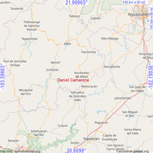
Daniel Camarena GPS coordinates[2]
21° 20' 46.464" North, 102° 53' 36.6" West
| Map corner | latitude | longitude |
|---|---|---|
| Upper-left | 21.99965°, | -103.59663° |
| Center: | 21.34624°, | -102.8935° |
| Lower-right: | 20.6899°, | -102.19038° |
| Map W x H: | 145.6×145.6 km | = 90.5×90.5mi |
| max Lat: | 32.7° ⇑19.6% North |
| Daniel Camarena: | 21.34624° |
| min Lat: | ⇓80.4% South 14.53588° |
| min Long | Daniel Camarena | max Long |
| -117.105° | -102.8935° | -86.73105° |
| W 14.6%⇐ | ⇒85.4% E |
Elevation
Elevation of Daniel Camarena is 1921 m = 6302 ft, and this is 667.3 m = 2189 ft above average elevation for this country.
| Max E: |
3497 m = 11473 ft | 30.1% |
| Daniel Camarena | 1921 m 6302 ft | |
| Avg. | 1253.7 m = 4113 ft | |
Min E: |
-1 m = -3 ft | 69.9% |
See also: Mexico elevation on elevation.city.
Geographical zone
Daniel Camarena is located in North Torrid zone (between Equator and Tropic of Cancer). Distance of this Northern Tropic circle is 232.4 km =144.4 mi to North.| Distance of | km | miles | from Daniel Camarena |
|---|---|---|---|
| North Pole | 7633.6 | 4743.3 | to North |
| Arctic Circle | 5027.7 | 3124.1 | to North |
| Tropic Cancer | 232.4 | 144.4 | to North |
| Equator | 2373.5 | 1474.8 | to South |


Nearby cities:
15 places around Daniel Camarena: (largest is in red/bold)
• Apozol
24.6 km =15.3 mi,  303°
303°
• Apulco
22.4 km =13.9 mi,  77°
77°
• Bonifacio Falcón
25.3 km =15.7 mi,  286°
286°
• Colonia Lindavista
4.7 km =2.9 mi,  48°
48°
• Colonia Lomas del Refugio
7.2 km =4.5 mi, 75°
• El Mirador
20 km =12.4 mi,  173°
173°
• El Remolino
24.1 km =15 mi,  274°
274°
• Huisquilco
25 km =15.5 mi,  201°
201°
• Juchipila
24.1 km =15 mi, 286°
• Los Llamas
26.8 km =16.7 mi,  310°
310°
• Mexticacán
14.8 km =9.2 mi,  127°
127°
• Nochistlán de Mejía
5.3 km =3.3 mi,  67°
67°
• San José (San José de los Meléndez)
25.4 km =15.8 mi, 289°
• Tlachichila
26 km =16.2 mi,  25°
25°
• Yahualica de González Gallo
18.5 km =11.5 mi,  177°
177°
Sources, notices
• [Note1] Compared only with cities in Mexico existing in our database
• [Src1] Map data: © OpenStreetMap contributors (CC-BY-SA)
• [Src2] Other city data from geonames.org with taken over terms of usage.
• [Src3] Geographical zone / Annual Mean Temperature by Robert A. Rohde @ Wikipedia
