Los Llamas geodata
Los Llamas (Zacatecas) is a populated place; located in Mexico in America/Mexico_City (GMT-6) time zone. With population of 806 people, there are 10834 cities with bigger population in this country. Compared to other cities in Mexico, 81.4% of cities are located further ↓South; 86% of cities are located further →East and 52.6% of cities have higher elevation than Los Llamas. Note1


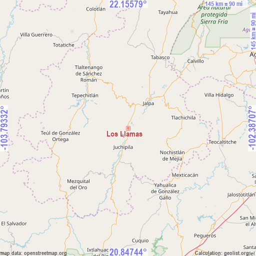
Los Llamas GPS coordinates[2]
21° 30' 11.124" North, 103° 5' 24.684" West
| Map corner | latitude | longitude |
|---|---|---|
| Upper-left | 22.15579°, | -103.79332° |
| Center: | 21.50309°, | -103.09019° |
| Lower-right: | 20.84744°, | -102.38707° |
| Map W x H: | 145.5×145.5 km | = 90.4×90.4mi |
| max Lat: | 32.7° ⇑18.6% North |
| Los Llamas: | 21.50309° |
| min Lat: | ⇓81.4% South 14.53588° |
| min Long | Los Llamas | max Long |
| -117.105° | -103.09019° | -86.73105° |
| W 14%⇐ | ⇒86% E |
Elevation
Elevation of Los Llamas is 1312 m = 4304 ft, and this is 58.3 m = 191 ft above average elevation for this country.
| Max E: |
3497 m = 11473 ft | 52.6% |
| Los Llamas | 1312 m 4304 ft | |
| Avg. | 1253.7 m = 4113 ft | |
Min E: |
-1 m = -3 ft | 47.4% |
See also: Mexico elevation on elevation.city.
Geographical zone
Los Llamas is located in North Torrid zone (between Equator and Tropic of Cancer). Distance of this Northern Tropic circle is 215 km =133.6 mi to North.| Distance of | km | miles | from Los Llamas |
|---|---|---|---|
| North Pole | 7616.1 | 4732.4 | to North |
| Arctic Circle | 5010.3 | 3113.3 | to North |
| Tropic Cancer | 215 | 133.6 | to North |
| Equator | 2390.9 | 1485.6 | to South |


Nearby cities:
15 places around Los Llamas: (largest is in red/bold)
• Apozol
3.7 km =2.3 mi,  180°
180°
• Bonifacio Falcón
10.9 km =6.8 mi,  200°
200°
• Colonia Lindavista
27.8 km =17.3 mi,  121°
121°
• Colonia Unión Obrera
19.7 km =12.2 mi,  31°
31°
• Cuxpala
27.7 km =17.2 mi,  210°
210°
• Daniel Camarena
26.8 km =16.7 mi,  130°
130°
• El Remolino
15.8 km =9.8 mi,  193°
193°
• Guadalupe Victoria
24.8 km =15.4 mi,  19°
19°
• Jalpa
18.6 km =11.6 mi,  38°
38°
• Juchipila
10.9 km =6.8 mi, 194°
• Los Santiagos
21.6 km =13.4 mi, 38°
• Moyahua de Estrada
27.4 km =17 mi, 196°
• Nochistlán de Mejía
29.6 km =18.4 mi, 121°
• San José (San José de los Meléndez)
9.8 km =6.1 mi, 201°
• San Pedro Ocotlán
22.8 km =14.2 mi,  279°
279°
Sources, notices
• [Note1] Compared only with cities in Mexico existing in our database
• [Src1] Map data: © OpenStreetMap contributors (CC-BY-SA)
• [Src2] Other city data from geonames.org with taken over terms of usage.
• [Src3] Geographical zone / Annual Mean Temperature by Robert A. Rohde @ Wikipedia
