Juchipila geodata
Juchipila (Zacatecas) is a seat of a second-order administrative division; located in Mexico in America/Mexico_City (GMT-6) time zone. With population of 6,035 people, there are 1551 cities with bigger population in this country. Compared to other cities in Mexico, 80.9% of cities are located further ↓South; 86.2% of cities are located further →East and 53.9% of cities have higher elevation than Juchipila. Note1


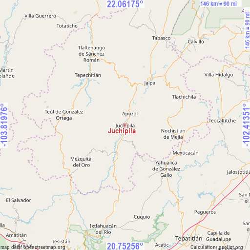
Juchipila GPS coordinates[2]
21° 24' 31.032" North, 103° 6' 59.868" West
| Map corner | latitude | longitude |
|---|---|---|
| Upper-left | 22.06175°, | -103.81976° |
| Center: | 21.40862°, | -103.11663° |
| Lower-right: | 20.75256°, | -102.41351° |
| Map W x H: | 145.6×145.6 km | = 90.5×90.5mi |
| max Lat: | 32.7° ⇑19.1% North |
| Juchipila: | 21.40862° |
| min Lat: | ⇓80.9% South 14.53588° |
| min Long | Juchipila | max Long |
| -117.105° | -103.11663° | -86.73105° |
| W 13.8%⇐ | ⇒86.2% E |
Elevation
Elevation of Juchipila is 1248 m = 4094 ft, and this is 5.7 m = 19 ft below average elevation for this country.
| Max E: |
3497 m = 11473 ft | 53.9% |
| Avg. | 1253.7 m = 4113 ft | |
| Juchipila | 1248 m = 4094 ft | |
Min E: |
-1 m = -3 ft | 46.1% |
See also: Mexico elevation on elevation.city.
Geographical zone
Juchipila is located in North Torrid zone (between Equator and Tropic of Cancer). Distance of this Northern Tropic circle is 225.5 km =140.1 mi to North.| Distance of | km | miles | from Juchipila |
|---|---|---|---|
| North Pole | 7626.6 | 4738.9 | to North |
| Arctic Circle | 5020.8 | 3119.8 | to North |
| Tropic Cancer | 225.5 | 140.1 | to North |
| Equator | 2380.4 | 1479.1 | to South |


Nearby cities:
15 places around Juchipila: (largest is in red/bold)
• Apozol
7.3 km =4.5 mi,  21°
21°
• Bonifacio Falcón
1.2 km =0.7 mi,  286°
286°
• Colonia Lindavista
26.9 km =16.7 mi,  98°
98°
• Colonia Lomas del Refugio
30.5 km =19 mi, 99°
• Colonia Unión Obrera
30.3 km =18.8 mi,  25°
25°
• Cuxpala
17.5 km =10.9 mi,  220°
220°
• Daniel Camarena
24.1 km =15 mi,  106°
106°
• El Remolino
5 km =3.1 mi,  190°
190°
• Jalpa
28.9 km =18 mi, 29°
• Los Llamas
10.9 km =6.8 mi,  14°
14°
• Los Santiagos
31.8 km =19.8 mi, 30°
• Moyahua de Estrada
16.6 km =10.3 mi,  197°
197°
• Nochistlán de Mejía
28.5 km =17.7 mi, 99°
• San José (San José de los Meléndez)
1.6 km =1 mi,  326°
326°
• San Pedro Ocotlán
24.4 km =15.2 mi,  306°
306°
Sources, notices
• [Note1] Compared only with cities in Mexico existing in our database
• [Src1] Map data: © OpenStreetMap contributors (CC-BY-SA)
• [Src2] Other city data from geonames.org with taken over terms of usage.
• [Src3] Geographical zone / Annual Mean Temperature by Robert A. Rohde @ Wikipedia
