La Barca geodata
La Barca (Jalisco) is a seat of a second-order administrative division; located in Mexico in America/Mexico_City (GMT-6) time zone. With population of 35,219 people, there are 291 cities with bigger population in this country. Compared to other cities in Mexico, 63.3% of cities are located further ↓South; 84.3% of cities are located further →East and 52.8% of cities have lower elevation than La Barca. Note1


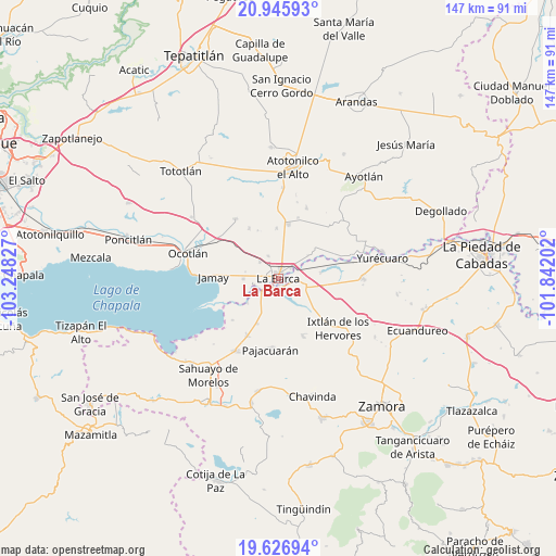
La Barca GPS coordinates[2]
20° 17' 16.224" North, 102° 32' 42.504" West
| Map corner | latitude | longitude |
|---|---|---|
| Upper-left | 20.94593°, | -103.24827° |
| Center: | 20.28784°, | -102.54514° |
| Lower-right: | 19.62694°, | -101.84202° |
| Map W x H: | 146.7×146.7 km | = 91.2×91.2mi |
| max Lat: | 32.7° ⇑36.7% North |
| La Barca: | 20.28784° |
| min Lat: | ⇓63.3% South 14.53588° |
| min Long | La Barca | max Long |
| -117.105° | -102.54514° | -86.73105° |
| W 15.7%⇐ | ⇒84.3% E |
Elevation
Elevation of La Barca is 1537 m = 5043 ft, and this is 283.3 m = 929 ft above average elevation for this country.
| Max E: |
3497 m = 11473 ft | 47.2% |
| La Barca | 1537 m 5043 ft | |
| Avg. | 1253.7 m = 4113 ft | |
Min E: |
-1 m = -3 ft | 52.8% |
See also: Mexico elevation on elevation.city.
Geographical zone
La Barca is located in North Torrid zone (between Equator and Tropic of Cancer). Distance of this Northern Tropic circle is 350.1 km =217.5 mi to North.| Distance of | km | miles | from La Barca |
|---|---|---|---|
| North Pole | 7751.3 | 4816.4 | to North |
| Arctic Circle | 5145.4 | 3197.2 | to North |
| Tropic Cancer | 350.1 | 217.5 | to North |
| Equator | 2255.8 | 1401.7 | to South |


Nearby cities:
15 places around La Barca: (largest is in red/bold)
• Briseñas de Matamoros
2.8 km =1.7 mi,  218°
218°
• Cumuato
5.8 km =3.6 mi,  234°
234°
• El Capulín
8.8 km =5.5 mi,  139°
139°
• El Loreto Occidental
9.8 km =6.1 mi,  51°
51°
• El Mirto
7.6 km =4.7 mi,  359°
359°
• La Paz de Ordaz
6.5 km =4 mi,  13°
13°
• La Providencia
8.9 km =5.5 mi,  280°
280°
• La Puerta de Guamúchil
4.4 km =2.7 mi,  3°
3°
• Paso de Hidalgo (Paso de Álamos)
1.7 km =1.1 mi,  180°
180°
• San Agustín
9.2 km =5.7 mi,  268°
268°
• San Francisco de Rivas
6.5 km =4 mi,  334°
334°
• San José de las Moras
6.5 km =4 mi,  310°
310°
• San Pedro de Ruíz
2.7 km =1.7 mi, 267°
• Vista Hermosa de Negrete
7.5 km =4.7 mi,  103°
103°
• Zalamea
4.7 km =2.9 mi, 52°
Sources, notices
• [Note1] Compared only with cities in Mexico existing in our database
• [Src1] Map data: © OpenStreetMap contributors (CC-BY-SA)
• [Src2] Other city data from geonames.org with taken over terms of usage.
• [Src3] Geographical zone / Annual Mean Temperature by Robert A. Rohde @ Wikipedia
