El Loreto Occidental geodata
El Loreto Occidental (Jalisco) is a populated place; located in Mexico in America/Mexico_City (GMT-6) time zone. With population of 1,266 people, there are 6839 cities with bigger population in this country. Compared to other cities in Mexico, 64.4% of cities are located further ↓South; 83.9% of cities are located further →East and 52.9% of cities have lower elevation than El Loreto Occidental. Note1
Current local time in El Loreto Occidental:
03:42 AM, WednesdayDifference from your time zone: hours


El Loreto Occidental GPS coordinates[2]
20° 20' 31.992" North, 102° 28' 15.348" West
| Map corner | latitude | longitude |
|---|---|---|
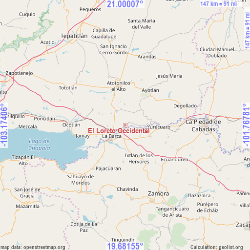
| Upper-left | 21.00007°, | -103.17406° |
| Center: | 20.34222°, | -102.47093° |
| Lower-right: | 19.68155°, | -101.76781° |
| Map W x H: | 146.6×146.6 km | = 91.1×91.1mi |
| max Lat: | 32.7° ⇑35.6% North |
| El Loreto Occidental: | 20.34222° |
| min Lat: | ⇓64.4% South 14.53588° |
| min Long | El Loreto Occid | max Long |
| -117.105° | -102.47093° | -86.73105° |
| W 16.1%⇐ | ⇒83.9% E |
Elevation
Elevation of El Loreto Occidental is 1539 m = 5049 ft, and this is 285.3 m = 936 ft above average elevation for this country.
| Max E: |
3497 m = 11473 ft | 47.1% |
| El Loreto Occidental | 1539 m 5049 ft | |
| Avg. | 1253.7 m = 4113 ft | |
Min E: |
-1 m = -3 ft | 52.9% |
See also: Mexico elevation on elevation.city.
Geographical zone
El Loreto Occidental is located in North Torrid zone (between Equator and Tropic of Cancer). Distance of this Northern Tropic circle is 344.1 km =213.8 mi to North.| Distance of | km | miles | from El Loreto Occidental |
|---|---|---|---|
| North Pole | 7745.2 | 4812.6 | to North |
| Arctic Circle | 5139.3 | 3193.4 | to North |
| Tropic Cancer | 344.1 | 213.8 | to North |
| Equator | 2261.8 | 1405.4 | to South |


Nearby cities:
15 places around El Loreto Occidental: (largest is in red/bold)
• El Alvareño
5.8 km =3.6 mi,  142°
142°
• El Carmen
8.9 km =5.5 mi,  36°
36°
• El Cuenqueño
2.2 km =1.4 mi, 139°
• El Gobernador
5.5 km =3.4 mi,  15°
15°
• El Mirto
7.9 km =4.9 mi,  281°
281°
• La Barca
9.8 km =6.1 mi,  231°
231°
• La Paz de Ordaz
6.2 km =3.9 mi,  272°
272°
• La Puerta de Guamúchil
7.6 km =4.7 mi,  257°
257°
• Portezuelo
9.3 km =5.8 mi,  327°
327°
• San Antonio de Rivas
4.6 km =2.9 mi,  78°
78°
• San José Casas Caídas
9.3 km =5.8 mi, 19°
• San Ramón
2 km =1.2 mi,  48°
48°
• Villa de García Márquez
10.2 km =6.3 mi,  345°
345°
• Vista Hermosa de Negrete
7.9 km =4.9 mi,  183°
183°
• Zalamea
5.1 km =3.2 mi, 231°
Sources, notices
• [Note1] Compared only with cities in Mexico existing in our database
• [Src1] Map data: © OpenStreetMap contributors (CC-BY-SA)
• [Src2] Other city data from geonames.org with taken over terms of usage.
• [Src3] Geographical zone / Annual Mean Temperature by Robert A. Rohde @ Wikipedia
