Vista Hermosa de Negrete geodata
Vista Hermosa de Negrete (Michoacán) is a seat of a second-order administrative division; located in Mexico in America/Mexico_City (GMT-6) time zone. With population of 10,752 people, there are 885 cities with bigger population in this country. Compared to other cities in Mexico, 62.9% of cities are located further ↓South; 83.9% of cities are located further →East and 52.8% of cities have lower elevation than Vista Hermosa de Negrete. Note1
Current local time in Vista Hermosa de Negrete:
06:07 AM, TuesdayDifference from your time zone: hours


Vista Hermosa de Negrete GPS coordinates[2]
20° 16' 18.084" North, 102° 28' 29.568" West
| Map corner | latitude | longitude |
|---|---|---|
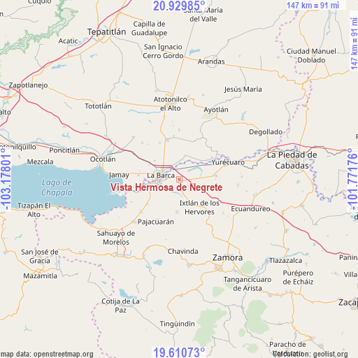
| Upper-left | 20.92985°, | -103.17801° |
| Center: | 20.27169°, | -102.47488° |
| Lower-right: | 19.61073°, | -101.77176° |
| Map W x H: | 146.7×146.7 km | = 91.2×91.2mi |
| max Lat: | 32.7° ⇑37.1% North |
| Vista Hermosa de Negrete: | 20.27169° |
| min Lat: | ⇓62.9% South 14.53588° |
| min Long | Vista Hermosa d | max Long |
| -117.105° | -102.47488° | -86.73105° |
| W 16.1%⇐ | ⇒83.9% E |
Elevation
Elevation of Vista Hermosa de Negrete is 1537 m = 5043 ft, and this is 283.3 m = 929 ft above average elevation for this country.
| Max E: |
3497 m = 11473 ft | 47.2% |
| Vista Hermosa de Negrete | 1537 m 5043 ft | |
| Avg. | 1253.7 m = 4113 ft | |
Min E: |
-1 m = -3 ft | 52.8% |
See also: Mexico elevation on elevation.city.
Geographical zone
Vista Hermosa de Negrete is located in North Torrid zone (between Equator and Tropic of Cancer). Distance of this Northern Tropic circle is 351.9 km =218.7 mi to North.| Distance of | km | miles | from Vista Hermosa de Negrete |
|---|---|---|---|
| North Pole | 7753.1 | 4817.6 | to North |
| Arctic Circle | 5147.2 | 3198.3 | to North |
| Tropic Cancer | 351.9 | 218.7 | to North |
| Equator | 2254 | 1400.6 | to South |


Nearby cities:
15 places around Vista Hermosa de Negrete: (largest is in red/bold)
• Briseñas de Matamoros
9.1 km =5.7 mi,  267°
267°
• El Alvareño
5.1 km =3.2 mi,  50°
50°
• El Capulín
5.1 km =3.2 mi,  197°
197°
• El Cuenqueño
6.5 km =4 mi,  16°
16°
• El Loreto Occidental
7.9 km =4.9 mi,  3°
3°
• La Angostura
9.1 km =5.7 mi,  157°
157°
• La Barca
7.5 km =4.7 mi,  283°
283°
• La Paz de Ordaz
10 km =6.2 mi,  324°
324°
• La Puerta de Guamúchil
9.4 km =5.8 mi,  311°
311°
• Los Charcos
7 km =4.3 mi,  96°
96°
• Paso de Hidalgo (Paso de Álamos)
7.3 km =4.5 mi, 270°
• San Antonio de Rivas
10 km =6.2 mi,  29°
29°
• San Pedro de Ruíz
10.1 km =6.3 mi, 279°
• San Ramón
9.4 km =5.8 mi,  11°
11°
• Zalamea
5.9 km =3.7 mi, 322°
Sources, notices
• [Note1] Compared only with cities in Mexico existing in our database
• [Src1] Map data: © OpenStreetMap contributors (CC-BY-SA)
• [Src2] Other city data from geonames.org with taken over terms of usage.
• [Src3] Geographical zone / Annual Mean Temperature by Robert A. Rohde @ Wikipedia
